Subject: Canada, Lake Winnipeg
Period: 1825 (circa)
Publication:
Color: Hand Color
Size:
22 x 18.3 inches
55.9 x 46.5 cm
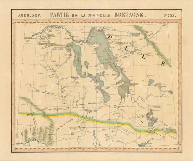
This interesting map is centered on Lake Winnipeg and details early exploration and settlement in the region. The Fort Gerry Colony, started by Lord Selkirk in 1811 and the first settlement in the area, is shown as well as other settlements started by rival fur trading companies, Hudson's Bay Company and the Northwest Company. The majority of the region is shown to be the preserve of various Indian tribes. The Atlas Universel was the first atlas to present all the maps on the same scale (1: 1,641,836), with each map covering an area of approximately 20 degrees longitude (from Paris) and 6 degrees of latitude. The Atlas Universel is considered to be the first lithographic atlas ever published. The maps were meant to be joined together to form a huge globe. There was only one edition of the atlas, published in 1825-27, and the subscription list shows that 810 copies were sold. A beautiful example of a remarkable and scarce map.
References:
Condition: A
An attractive sheet with original color and some faint, irregular toning. There is a minor paper flaw in an unengraved portion of the map