Subject: Canada, Newfoundland
Period: 1764 (published)
Publication: La Petit Atlas Maritime
Color: Black & White
A matched set of boldly engraved copper plate maps.
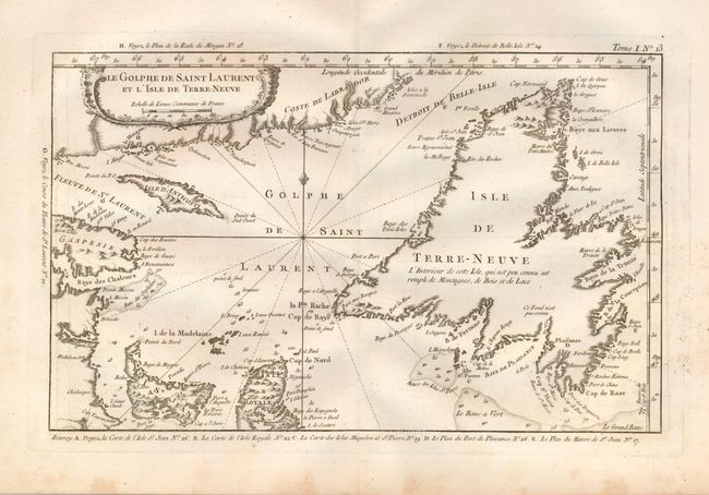
1) Le Golfe de Saint Laurent et l'Isle de Terre-Neuve. (13.5 x 8.5"). A well engraved chart that details the sea around the outlet of the St. Laurence River. Newfoundland, Isle d'Anticosti, Prince Edward Island, part of Cape Breton Island, and the coast of Labrador are located. The map extends to the Strait of Belle Island but not to Belle Island. Rococo-style cartouche decorates the map and a fleur-de-lys lies above the intersection of rhumb lines. Grade B+. Light foxing mostly in margins.
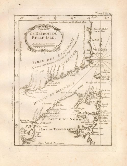
2) Le Detroit de Belle-Isle. (6.3 x 8.3"). This very finely engraved chart details the strait between Labrador and the Long Range Mountain region of Newfoundland, here called Terre-Neuve. A nice rococo-style cartouche floats at upper left and a fleur-de-lys caps the intersection of rhumb lines. Grade B+. Light foxing mostly in margins.
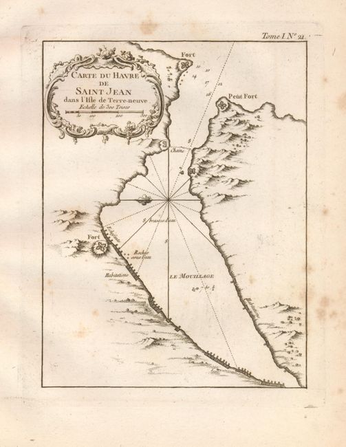
3) Carte de Havre de Saint Jean dans l'Isle de Terre-Neuve. (6.3 x 8.3"). Has well defined topography, and shows several forts. A nice rococo-style cartouche floats at upper left and a fleur-de-lys caps the intersection of rhumb lines. Grade B+. Moderate foxing mostly in margins.
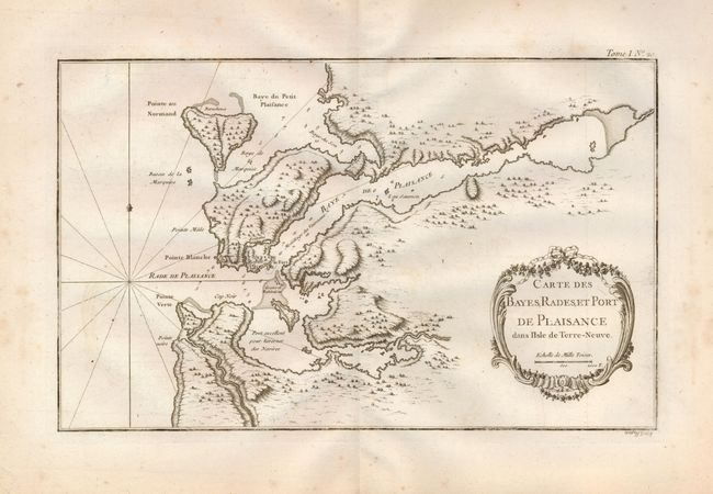
4) Carte des Bayes, Rades, et Port de Plaisance dans l'Isle de Terre Neuve. The French fort, village, and battery are shown at the harbor entrance. These harbors were used to over-winter fleets and the harbors are so marked A nice rococo-style cartouche floats lower right and a fleur-de-lys caps the intersection of rhumb lines. (13.8 x 8.6"). Grade B+. Light foxing mostly in margins.
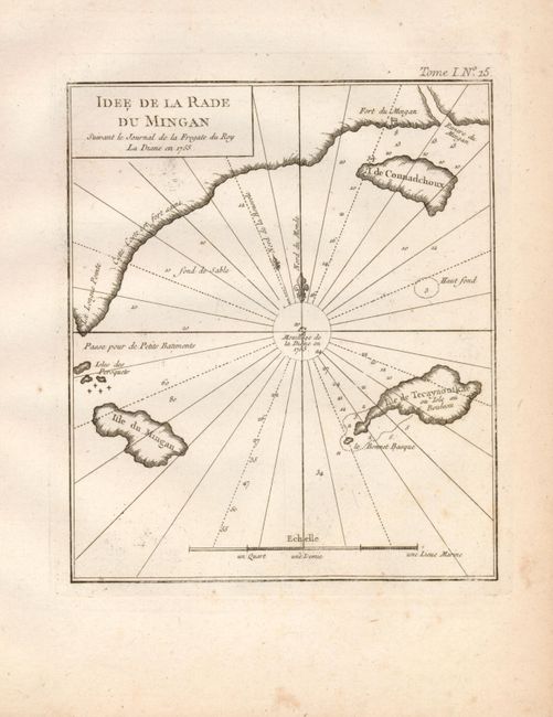
5) Idee de la Rade du Mingan. (6.5 x 7.7"). is a copper engraved chart of the north shore of the Saint Lawrence River from the mouth of the Mingan River and Fort du Mingan to Longe Point. The chart was based on the Journal of the Frigate La Diane in 1755 and published in the Petit Atlas Maritime, Vol. 1, 1762. Grade B+. Light foxing mostly in margins.
References:
Condition:
See individual descriptions.