Subject: Western Hemisphere
Period: 1658 (circa)
Publication:
Color: Hand Color
Size:
21.3 x 17.1 inches
54.1 x 43.4 cm
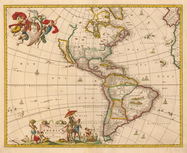
Visscher's map greatly influenced the cartography of the Americas both geographically and artistically for many years. One of the most distinctive geographic details that was copied by other cartographers is the large open lake in the Great Lakes region. Visscher actually copied this from Blaeu's wall map of the world [1648], but popularized it with the publication of this map. California is shown as an island, on the Briggs model, but with a broader northern coastline. The map is embellished with two large cartouches that were also copied by other cartographers. The top cartouche features a dedication to Cornelis Witsen and depicts angels struggling with a devil for the soul of a Native American. The pictorial title cartouche contains scenes of gold panning, hunting and a native chief standing beneath an umbrella. This is the first state, lacking the privilege that was added along the lower margin in 1677.
References: Burden #332; McLaughlin #48; Tooley (Amer) p. 119, #29; Wagner (NW) #378.
Condition: B+
A little creasing at lower centerfold and expert repair to lower centerfold split.