Subject: Pacific Ocean
Period: 1789-1860 (circa)
Publication:
Color:
Interesting group of maps focused on the Pacific, including expeditions.
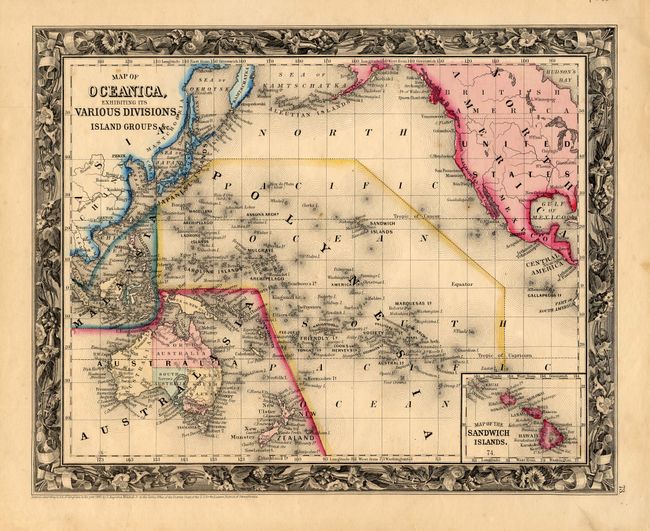
1) Map of Oceanica, Exhibiting its Various Divisions, Island Groups, &c. By S. Augustus Mitchell, 1860. Insets of Australasia and Sandwich Islands. Hand colored (13 x 10.5").
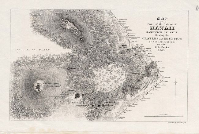
2) Map of Part of the Island of Hawaii Sandwich Islands Shewing the Craters and Eruption of May and June 1841 by the U. S. Ex. Ex. 1841. Black and white engraving ( 8 x 4.5").
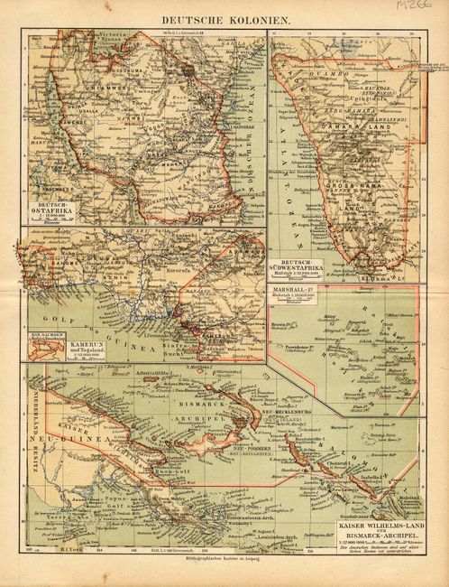
3) Deutsche Kolonien. Liepzig. Five German colonies: East Africa, Southwest Africa, Cameroon in Africa; Marshall Islands, Kaiser Wilhems-Land, Bismarck Archipelago in Pacific. Printed color (8.3 x 11") .
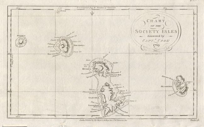
4) Chart of the Society Islands discovered by Capt. Cook 1769, by Alexr. Hogg, London. Black and white engraving (14 x 8").
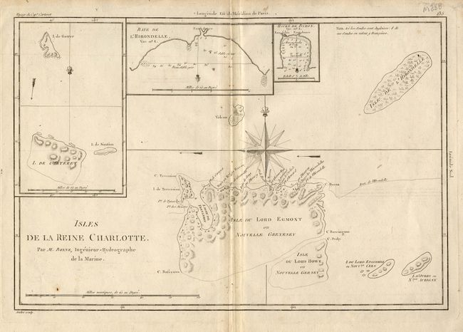
5) Isles de la Reine Charlotte. Par M. Bonne. Three insets, shows Carteret's ship and the Swallow's track. Black and white engraving (13.5 x 9").
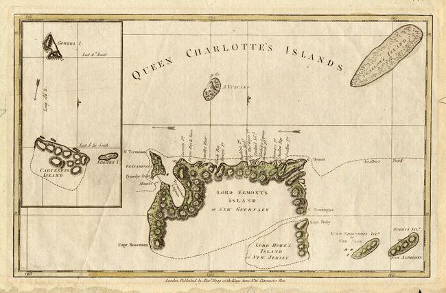
6) Queen Charlotte's Islands, by Alexr. Hogg, London, 1789. Inset, shows Carteret's ship and the Swallow's track. Hand colored ( 13 x 8.5") .
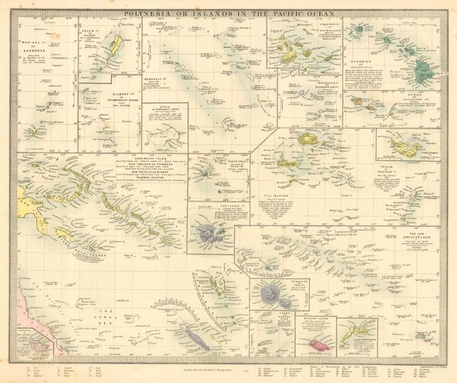
7) Polynesia or Islands in the Pacific Ocean, by Edward Stanford, London, 1860. 21 insets. Hand colored. (15.5 x 12.5")
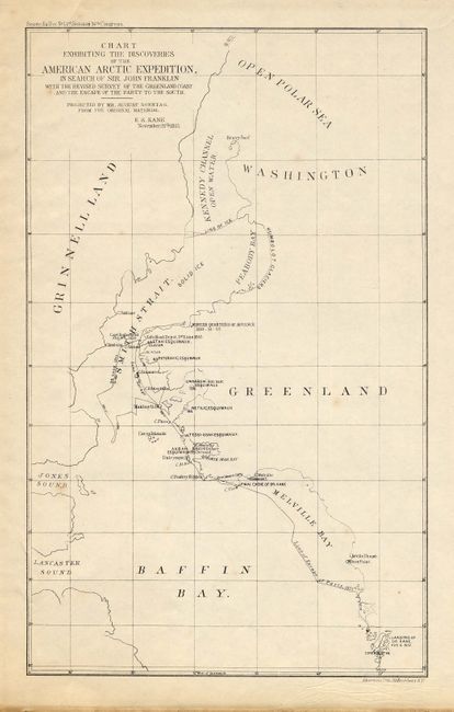
8) Chart Exhibiting the Discoveries of the American Arctic Expedition, in Search of Sir John Franklin with the Revised Survey of the Greenland Coast and the Escape of the Party to the South. E. K. Kane, 1855. Black and white map from Senate Ex Doc No. 1, 1st Session 34th Congress. (6 x 10").
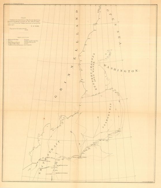
(9) Chart Exhibiting the discoveries of the Second American-Grimmell Expedition in Search of Sir John Franklin - Unrevised from the Original material and projected on the spot. E. K. Kane. 1855. Black and white map from Senate Ex Doc No. 1, 1st Session 34th Congress. (14.8 x 17.3").
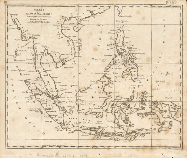
10) Chart of the East India Islands Exhibiting the several Passages, between the Indian and Pacific Oceans, by Arrowsmith & Lewis, 1819. Pencil notes on verso by James Anderson, 1830; on sloop Concord, M. C. Perry, Commander. Black and white engraving ( 10 x 8.5") .
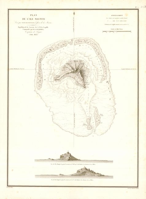
11) Plan de L'Isle Maupiti Seve par M. De Blosseville, Officier de la Marine. Expedition de la Corvette de S. M. la Coquille Commandee par M. L. I. Duperrey, Capitaine de Frigate. (Juin 1823), by Ambroise Tardieu, Paris. With two island views. Black and white engraving (12 x 19").
References:
Condition: B+
A little scattered foxing and some marginal chipping.