Catalog Archive
Auction 120, Lot 786

"Carte Marine Depuis Suratte jusqu'an Detroit Malaca Dressee par le R.P. Tachard de la Compagnie de Jesus Missionare et Mathematicien du Roy dans les Indies…", Nolin, Jean Batiste

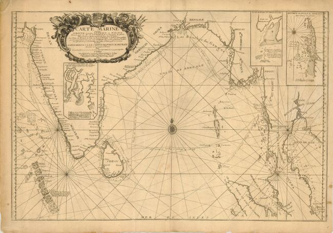
Subject: Bay of Bengal

Period: 1701 (dated)

Publication:

Color: Black & White

Size:
28.5 x 19 inches
72.4 x 48.3 cm
Download High Resolution Image
(or just click on image to launch the Zoom viewer)

Large and well engraved chart is centered on the Bay of Bengal. The map extends to show the Maldives, Ceylon (Sri Lanka), much of India, the flood plains of the Ganges River, Burma, and continuing around to Malacca on the Malaysian Peninsula. Shows most of Sumatra and names the Aceh region. Three insets detail the vicinity of Goa, the Port of Negrailles, and the Port of Mergui in Burma. The map details the route taken by the Jesuit Priest Guy Tachard in 1697. Beginning in 1685 Tachard spent many years in Asia, most of them working in Thailand. A large and uncommon Nolin issue.

References:

Condition: B

On thick hand laid paper with original margins. With one soft crease, some soiling and a marginal tears. The upper left corner is laid in with matching paper, well away from map image.

Estimate: $200 - $300

Sold for: $230

Closed on 7/18/2007

Archived