Catalog Archive
Auction 120, Lot 784

"Carte de l'Afrique Meridionale ou Pays entre la Ligne & le Cap de Bonne Esperance, et l'Isle de Madagascar", Elwe, Jan Barend

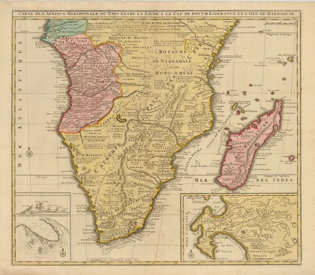
Subject: Southern Africa

Period: 1792 (dated)

Publication:

Color: Hand Color

Size:
23.8 x 19.8 inches
60.5 x 50.3 cm
Download High Resolution Image
(or just click on image to launch the Zoom viewer)

A fine folio map of Africa south of the Equator including all of Madagascar, with two interesting insets of the Cape of Good Hope. At left is plan of Table Bay with an elevation of Table Mountain, and at right is a large plan of the Cape Colony with extensive detail and fairly accurate topographical information including the names of early landowners. The main part of the map includes the various native kingdoms of the Interior and what was known then of the coastline, much of which is fictitious. The cartography is based on Visscher's map of 1710.

References: Norwich #180.

Condition: A

A nice impression on a sound sheet with good original margins and color. The map has a couple faint spots of foxing that do no detract from the map.

Estimate: $400 - $500

Sold for: $300

Closed on 7/18/2007

Archived