Subject: Arabia
Period: 1658 (circa)
Publication:
Color: Hand Color
Size:
21.5 x 17.4 inches
54.6 x 44.2 cm
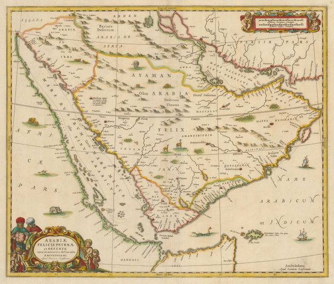
This lovely, uncommon map of the Arabian Peninsula was published during a period of expanding European cartographic knowledge driven by increased trade with the Orient. The coastlines are fairly well represented and the interior contains details of the navigable rivers; although this information and the locations of inland towns is largely speculative due to unreliable and often conflicting reports from merchants and explorers. The map is probably the most decorative map of Arabia available to collectors with the interior filled with lions, camels and elephants and a sea monster guarding the Fretum Babelmandel. The map is decorated with two figural cartouches featuring putti and depictions of the inhabitants of the region.
References: Tibbetts #101.
Condition: B+
Sharp impression and attractive original color with a light printer's crease in the lower right corner. The map has been professionally backed with Japanese tissue to repair and strengthen the centerfold and replace a small loss on the fold. The repairs were skillfully done and the loss does not affect the engraved surface and is only visible when held to a strong light.