Catalog Archive
Auction 120, Lot 569

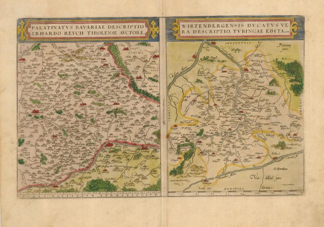
"Palatinatus Bavariae Descriptio Erhardo Reych Tirolense Auctore [on sheet with] Wirtenbergensis Ducatus Vera Descriptio, Tubingae Edita, 1558", Ortelius, Abraham
Subject: Germany

Period: 1579 (published)

Publication: Theatrum Orbis Terrarum

Color: Hand Color

Size:
15 x 11 inches
38.1 x 27.9 cm
Download High Resolution Image
(or just click on image to launch the Zoom viewer)

Two attractive maps on a folio sheet, each with their own strapwork cartouches, beautifully engraved by Frans Hogerberg. Both maps have charming pictorial depictions of cities and topography. Ortelius' map of Bayern (Bavariae) is based on the map by Erhart Reich. It is roughly centered on Amberg and extends to Nurnberg and Regensberg. The map of the Wurtemberg region (Wirtebergensis) is based on an anonymous map published in Tubingen in 1558. It is centered on Stuttgart and details the area between the Rhine and Danube rivers. Each map measures 9.5 x 12". Latin text on verso.

References: Van Den Broecke #111.

Condition: B

Wide original margins on a study sheet. There are a couple of light creases and a few minor stains.

Estimate: $200 - $250

Sold for: $150

Closed on 7/18/2007

Archived