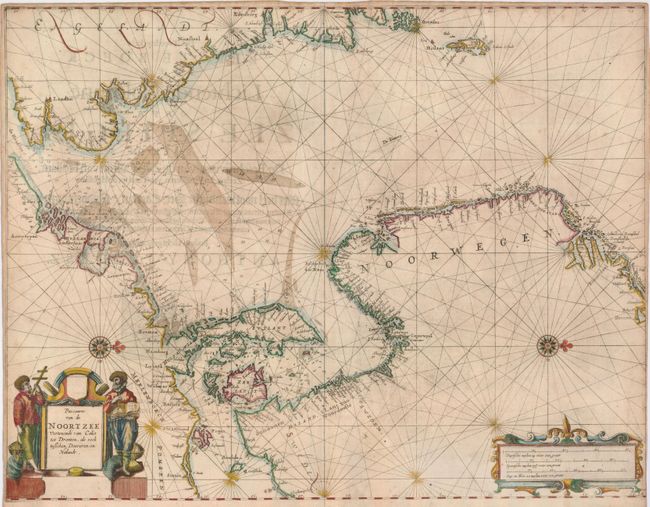
Subject: North Sea
Period: 1644 (dated)
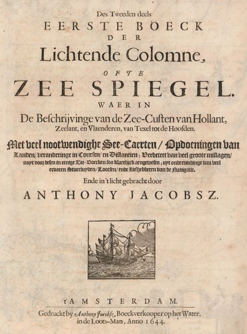
Publication: Lichtende Columne ofte Zee Spiegel
Color: Hand Color
Size:
22 x 16.8 inches
55.9 x 42.7 cm
Rare chart of the North Sea from the English Channel past the Orkney islands to Dronten on the west coast of Norway. The coasts are dotted with cities, including London, Calais, Amsterdam, Edinburgh and Bergen. The chart is crossed with rhumb lines, and a pair of compass roses orient north to the right. The title cartouche is flanked by a pair of chart makers in fur hats surrounded with the tools of their trade. This map is very similar to maps by Goos and Jansson that were published later. This example has not been recorded for sale in twenty years of price records. Dutch title page with the date on verso.
References: Tooley (MCC-71) #301.
Condition: B+
Printed on a strong sheet with nice color. There is a little faint foxing in the map and the original margins are narrow, nearly to neatline in the bottom right corner.