Subject: Arctic and Northern Europe
Period: 1598 (published)
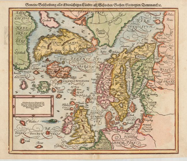
Publication: Cosmographia
Color: Hand Color
Size:
14 x 12 inches
35.6 x 30.5 cm
This attractive woodblock map is based on Ortelius' Septentrionalum of 1570, which in turn was based on the mapping of Nicholas Zeno in 1558. Petri had this woodblock cut in 1588, reverting to coverage of Munster's earlier, simpler map of Schonlandia. The map shows two Greenlands, one just above the other with the name of Groclandt, and the coast of Estotilandt (Newfoundland) is nearby. The imaginary islands of Frisland, Icaria, Podalida, and St. Brendain are shown, along with many other small, phantom islands in the North Sea. The North Pole carries a note of Pigmei hic habitandt, indicating that pygmies live there. Title is above the map. There is also a cartouche containing, "Schweden ist reich an Bergwerck Fischen…"
References: Burden #68.
Condition: B+
Dark impression on sound paper with attractive color. The map has some toning and a couple of light spots. One small binding hole in the lower margin, not affecting the map.