Subject: Southern South America
Period: 1778-1784 (circa)
Publication:
Color: Black & White
Nice group of maps focused on the southern tip of South America.
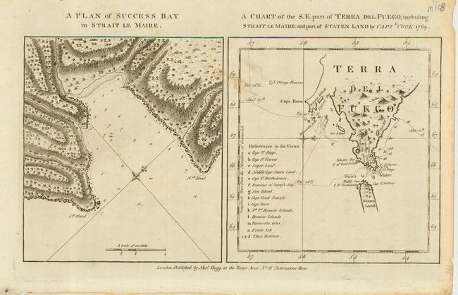
1) A Plan of Success Bay in Strait Le Maire [on sheet with] A Chart of the S. E. part of Terra del Fuego, including Strait Le Maire and part of Staten Land by Captn. Cook 1769. Alexander Hogg, London circa 1784 (maps together 13.5 x 7.2").
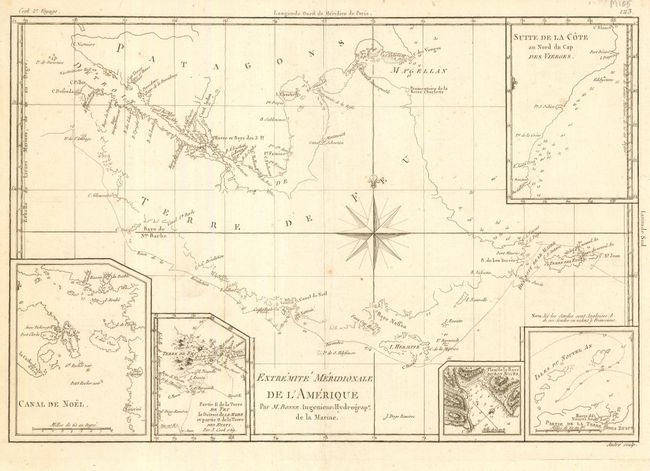
2) Extremite Meridionale de L'Amerique by Bonne, circa 1778. Five insets and a large compass rose. (13.5 x 9")
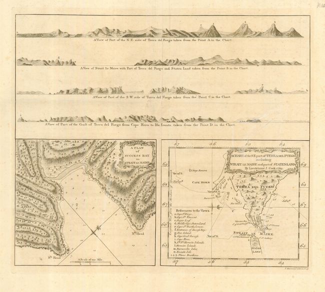
3) [Four coastal views of Terra del Fuego], A Plan of Success Bay in Strait le Maire, A Chart of the S. E. part of Terra del Fuego including Strait le Maire and part of Staten-Land By Lieutenant J. Cook 1769 (14 x 12").
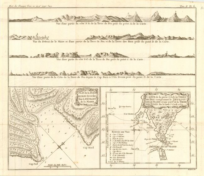
4) Duplicate of previous map in French by Benard. [Four coastal views of Terra del Fuego], Plan de la Baye Dubon Succes dans le Detroit de le Maire, Carte de la partie S.E. de la Terre de Feu comprenant le Detroit de le Maire et une partie de la Terre des Etats. Par le Lieut J. Cook 1769 (14 x 12").
References:
Condition: A
A couple faint stains.