Subject: World - Polar
Period: 1811-30
Publication:
Color:
A pair of wonderful polar projections that are filled with information.
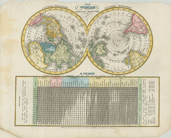
1) The World on a Globular Projection is from "A new and improved school atlas, to accompany the practical system of modern geography," By J. Olney… published in 1830 by D.F. Robinson. Below the map is "A Chart Exhibiting the progress of Christianity from the Birth of our Saviour to the Present Time." Full hand color. (9.8 x 8.3") Grade B+. Some soiling in margins. Binding edge a bit rough, one corner dog-eared and another with some loss well away from map.
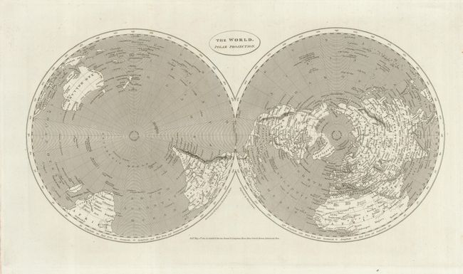
2)The World. Polar Projection.This example includes numerous place names and topographical details, plus occasional notes pointing out interesting facts such as "The last land discovered by Columbus in 1492" and "The Highest S. Latitude of Captain Cook." Highly detailed and finely engraved by Wilson Lowry and published by Cadell & Davies, etc. in 1811. B/W. (15.5 x 8") Grade A. Edges have some red smudges, otherwise fine.
References:
Condition:
See individual descriptions.