Subject: Lesser Antilles, Guadeloupe
Period: 1780-1823 (circa)
Publication:
Color: Hand Color
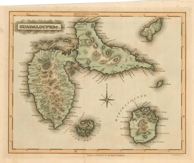
The first is by Fielding Lucas, Baltimore, 1823, 11.6" x 9.3". This a finely engraved and elegantly colored chart of the island group depicts numerous place names, rivers, churches and more. A simple compass rose and border finish the chart. Engraved by B.T. Welch.
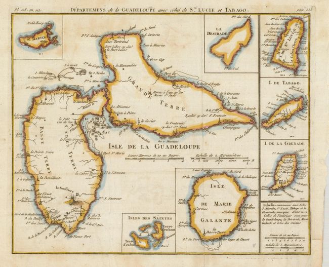
The second is a charming French map with insets of St. Martin, La Desirade, I. de St. Lucie, I. de Tabago, I. de Grenade, Isle de Marie Galante and Isles des Saintes. Rivers, towns, churches, anchorages and erupting volcanoes are shown. Chart has a simple border, scales. In upper margin is "Pl. 108, 111, 112" at left and "page 553" at right. This anonymous map measures 9.3" x 7.5" and is circa 1780. The pair.
References:
Condition: B
The first has a little marginal foxing and is printed askew on the paper. Left bottom corner is torn and reattached. The second was issued folding, now pressed and with one paper repair on verso of a fold split. Some light soiling or toning. Tape remnants on verso.