Subject: Guadeloupe
Period: 1764 (circa)
Publication: Petit Atlas Maritime
Color: Hand Color
This is a nice group of related maps. All are copper engravings and feature rococo-style cartouches, rhumb lines, and fleur-de-lys.
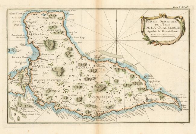
1) Partie Orientale de l'Isle de la Guadeloupe Appellee la Grande-Terre. (13.6 x 8.75") Great detail of the eastern portion of Guadeloupe. Locates Pointe-a-Pitre, Fort Louis, and more.
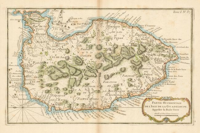
2) Partie Occidentale de l'Isle de la Guadeloupe Appellee la Basse Terre. (13.6 x 8.75") The matching map to #1, this details the western portion. A few light foxing marks in map.
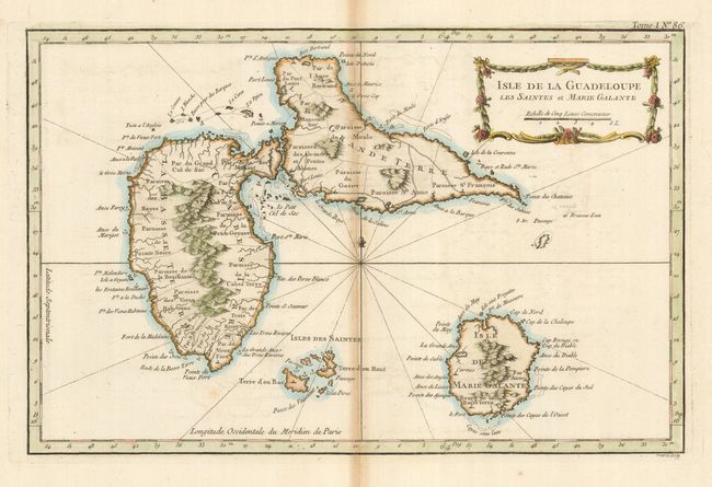
3) Isle de la Guadeloupe les Saintes et Marie Galante. (13.6 x 8.75") This is the general map of the entire island and extends to include the islands of Marie Galante, Isles des Saintes - Terre d' en Haut, Terre d'en Bas, etc. Early and strong impression with layout lines evident.
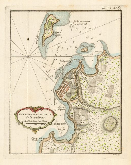
4) Environs du Fort Louis de la Guadeloupe. (6.6 x 8.5") Very detailed image of the fort and vicinity. Clean example, very good impression.
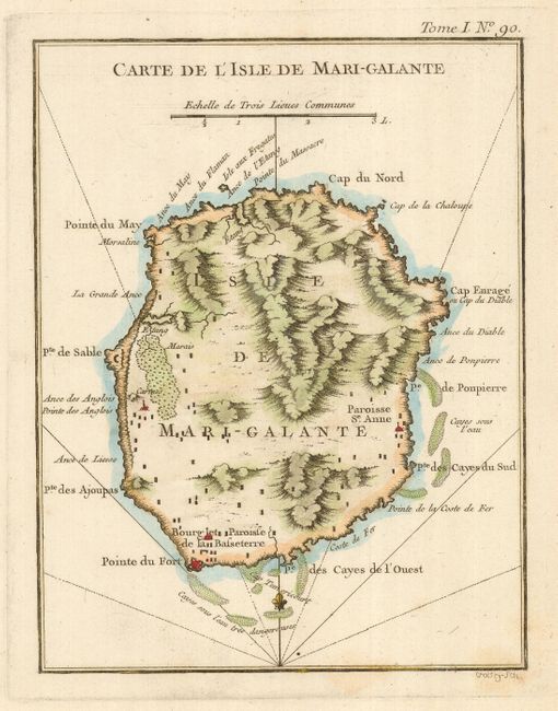
5) Carte de l'Isle de Mari-Galante. (6.5 x 8.4) Close detail of this island that lies just south of Guadeloupe. Clean example, very good.
References:
Condition: B
Dark impressions on thick paper. Each with a small portion of the lower right corner folded and broken off. The three double page maps show slight centerfold toning.