Subject: Gulf of Mexico and Caribbean
Period: 1775 (circa)
Publication: Hydrographie Francoise…
Color: Hand Color
Size:
31.5 x 21.3 inches
80 x 54.1 cm
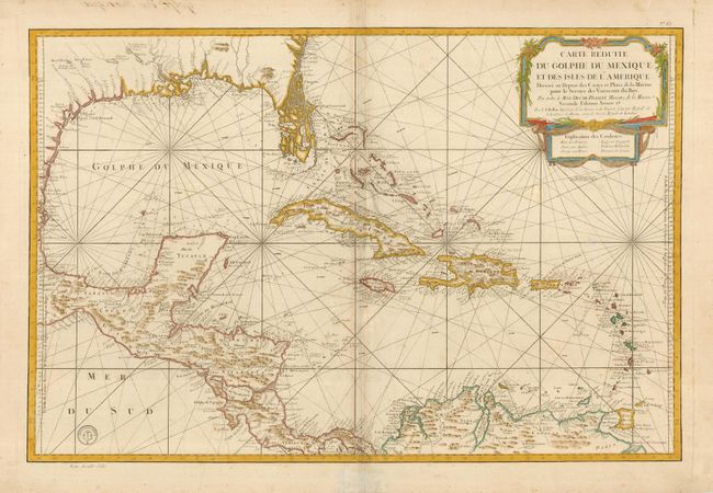
This large, impressive map of the Gulf of Mexico and the Caribbean includes Florida as a maze of islands. It is color-coded to indicate the different areas of European colonial influence. The map was clearly meant to facilitate sailing, with loxodromic lines, the locations of safe anchorages, navigational hazards and the directions of major currents. A lovely cartouche fills the upper right, with the color key underneath. Second state, as noted in the cartouche, with the stamp of the Depot de la Marine and a note of the cost with Prix trente Sols in the lower left.
References: cf Phillips (A) #588, Vol. 2 #67.
Condition: B
Sharp impression with attractive color. Two small abrasions in the map and some discoloration on the centerfold. Tissue repair on bottom margin.