Catalog Archive
Auction 120, Lot 348

"Map of the Texas & Pacific Railway and Connections", Railroad Companies, (Various)

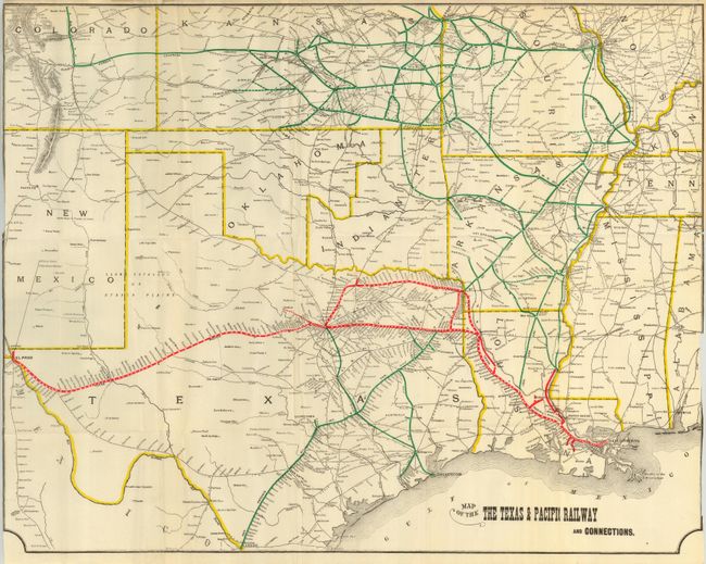
Subject: Texas & South Central United States

Period: 1893 (circa)

Publication:

Color: Printed Color

Size:
23 x 17.9 inches
58.4 x 45.5 cm
Download High Resolution Image
(or just click on image to launch the Zoom viewer)

Centered on Texas, the map extends to show the rail routes in Colorado, Kansas, Missouri, Oklahoma, Kansas and Indian Territory. Overprinted color locates numerous rails including the Texas & Pacific; San Antonio Div. Int. & Gt. Nor. Gulf; and several more. Connections travel to Pueblo, Wichita, Kansas City, St. Louis, Memphis, and New Orleans, to mention a few. Good detail of towns and the wagon road network of the day. Blank verso.

References:

Condition: B+

Folding as issued. Close margins, as issued, with a little toning in upper margin that also has a couple short tears or splits.

Estimate: $140 - $180

Sold for: $475

Closed on 7/18/2007

Archived