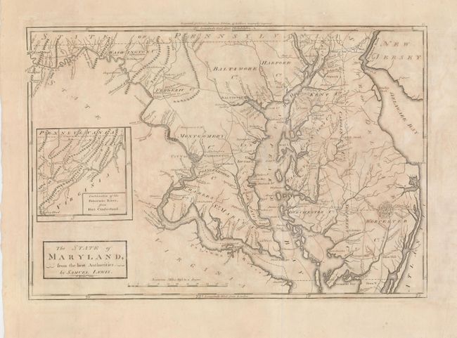
Subject: Maryland
Period: 1802 (circa)
Publication: Carey's American Edition of Guthrie's Geography improved
Color: Black & White
Size:
16.3 x 11 inches
41.4 x 27.9 cm
Second edition of the first American-produced atlas map of Maryland. Details include towns and villages, roads, and watershed of the state. The city of Washington is shown by a block plan with Georgetown. The western boundary line extends north along the course of the Potomac. Inset at left: "Continuation of the Potowmac River, from Fort Cumberland." The distance scale is in "American Miles." Engraved by William Barker who worked on other maps in Carey's American Atlas, where this map also appeared.
References: Wheat & Brun #511.
Condition: B
Nice impression on a sheet with wide, original margins. A little uneven toning and one tiny hole just under the cartouche. Another small hole is in the upper blank margin.