Subject: Louisiana
Period: 1855 (dated)
Publication:
Color: Black & White
Size:
46 x 23.5 inches
116.8 x 59.7 cm
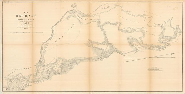
Large-scale chart shows soundings in the Red River from Shreveport to its confluence with Red Bayou. The 13-mile length of the river is marked and tributaries, topography, and adjacent lakes are indicated. Ownership of numerous land holdings are noted throughout this detailed chart. It locates Albany, Irwins Bluffs, proposed new channels, the route to Jefferson Texas, and more.
References:
Condition: B
The map was issued folding, now pressed and backed with archival tissue and lightly toned along two folds. The entire left edge with border was trimmed for binding, here replaced with new paper and the border in facsimile. No map information loss except for the "S" in Shreveport.