Subject: Western United States
Period: 1867 (dated)
Publication: 40th Cong., 2nd Sess.
Color: Black & White
Size:
41.5 x 27 inches
105.4 x 68.6 cm
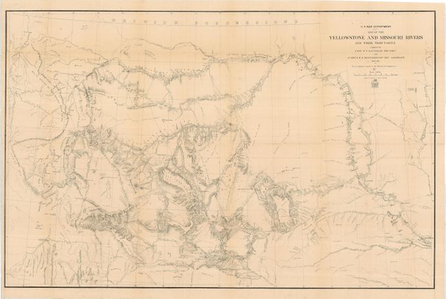
In 1859 - 60, W.R. Raynolds explored the extensive and then relatively unknown country drained by the Upper Missouri and Yellowstone Rivers. Dr. F. V. Hayden (who later led the expedition that resulted in the establishment of Yellowstone National Park in 1872) accompanied the expedition as a scientist and Jim Bridger acted as the expedition's guide. Only snowfall prevented Raynolds from being the first non-Indian to see the thermal regions of the Yellowstone area. Topography and hydrology are nicely developed and there is an abundance of interesting detail. Forts Reno, Phil Kearny and C.F. Smith, significant in the Sioux War, are shown. It also includes post-1860 developments such as Ft. Casper and Camp Marshall on the upper North Platte, several new forts and emigrant roads. Wheat considered it a very well drawn map and possibly the best map of the area to be produced at that time. Delayed for eight years due to a protracted illness and the Civil War, it was finalized due to expanding mining development and conflicts with Indian tribes in the region.
References: Wheat (TMW) 1012.
Condition: A
Issued folding, now pressed and backed with archival tissue. Just a hint of toning on a couple folds, still very good.