Subject: Central United States - Missouri & Arkansas
Period: 1826 (dated)
Publication: A New American Atlas…
Color: Hand Color
Size:
21.5 x 17 inches
54.6 x 43.2 cm
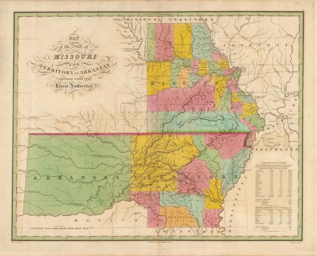
An uncommon map that shows the massive Arkansas Territory, taking up most of what will become Oklahoma and the Red River, as the boundary with Mexico. There are ten counties organized in the eastern section of Arkansas and 28 in Missouri. Many native tribes and villages are noted, as well as the locations of salt works, Military Bounty Lands, Missionary Stations, and a few roads. A table to the right describes the results of the census of 1820, noting populations of black and white settlers, as well as non-naturalized immigrants, and those engaged in manufacturing (179), commerce (77) and agriculture (3613). Drawn by D. H. Vance and engraved by J. H. Young.
References:
Condition: B
Lovely old color which has caused a little offsetting. Some minor toning on the centerfold.