Subject: Colonial Carolinas
Period: 1676 (circa)
Publication: A Prospect of the Most Famous Parts of the World
Color: Hand Color
Size:
5 x 3.3 inches
12.7 x 8.4 cm
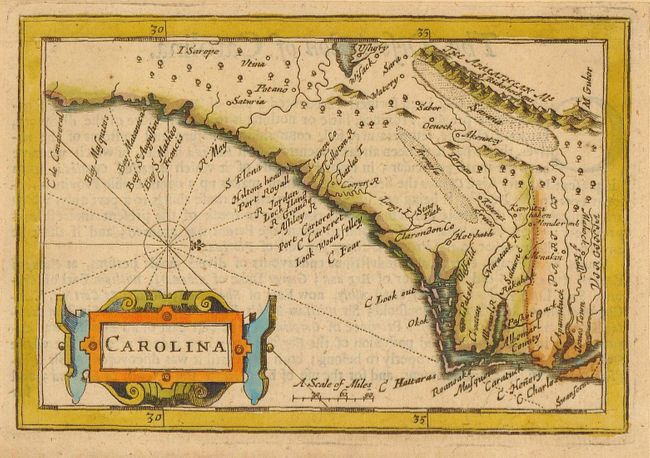
Miniature map based on the Montanus/Ogilby map of 1672, rather than Speed's map of Carolina, as evidenced by the appearance of the Eruco R. It is oriented with north to the right and covers the coast from Cape Charles to Cape Canaveral, naming Jamestown, Roanoake, Cape Hatteras, Hilton Head and many other coastal towns. The interior of the map shows pictorial topography with the Apalachian Mountain , and the May River originates in a large lake at their southern extent. A large cartouche adorns the map.
References: Cummings #76; King (2nd Ed.) pp. 103.
Condition: B+
Lovely impression and color. Margins trimmed to near platemark but still sufficient for framing.