Subject: Southern United States
Period: 1788 (dated)
Publication:
Color: Hand Color
Size:
19.5 x 12 inches
49.5 x 30.5 cm
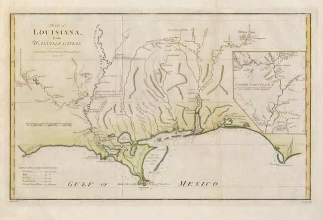
Lovely English version of d'Anville's 1732 Carte de la Louisiane, drawn by Haywood and engraved by Bowen. The map is focused on the Mississippi delta, showing the Red River as far as Adayes, a Spanish garrison of the Province of Tecas. The coastal area extends in the east from Cape San Blas and Apalachicola Bay (C. Escondido) to an area named Cabo del Norte shown with a small island off the cape. The northern portion of Louisiana Territory is portrayed in an inset. The map has many notations of towns destroyed by battles, both Indian and French.
References: Sellers & Van Ee #1616; cf Lemmon, Magill & Wiese, Charting Louisiana #24.
Condition: A
Issued folding, now pressed. Some minor discoloration in blank margins.