Subject: Eastern United States
Period: 1763-1840 (circa)
Publication:
Color: Black & White
Fascinating group of maps charting the early growth of the United States from the end of the eighteenth into the nineteenth century.
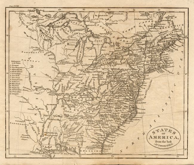
1) States of America, from the best Authorities by J. Russell circa 1796. Attractive small map of the young nation filled with a surprising amount of information. The map extends past the Mississippi River to show part of the new Louisiana Territory. Georgia's western boundary is the Mississippi and West Florida takes in the coastal region from the Chattahotcha River to the Mississippi River. Indian tribes are prominently named in the western territories. Key at left refers to 15 states, which does not include Tennessee, although it is shown on the map. The Twenty League Line is depicted off the east coast. Black and white engraving (9 x &.5").
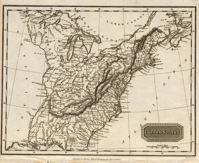
2) United States by Alexander Findlay, published by Thomas Kelly, circa 1800. Black and white engraving (9.8 x 7.5").
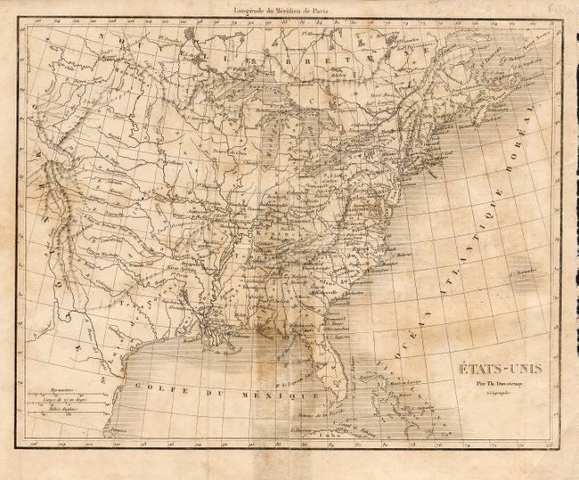
3) Etats-Unis by Th. Duvotenay, circa 1838. Black and white engraving (9 x 7").
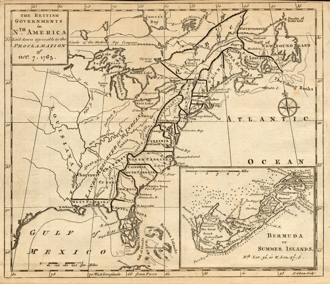
4) The British Governments in Nth. America Laid down agreeable to the Proclamation of Octr. 7. 1763, by John Gibson for Gentleman's Magazine. This great little map was designed to illustrate the new boundaries established at the end of the French and Indian War when England came into possession of the former French and Spanish settlements in Canada and Florida. It covers the east coast from Newfoundland down the coast to east and west Florida and the Bahamas and inland including the Great Lakes and French Louisiana. Lands reserved for the Indians are shown west of the Appalachians. Large inset "Bermuda or Summer Islands." Black and white engraving (9.3x 8").
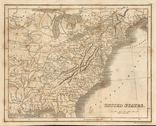
5) United States by Smith, circa 1820. Black and white engraving (9.5 x 7.5").
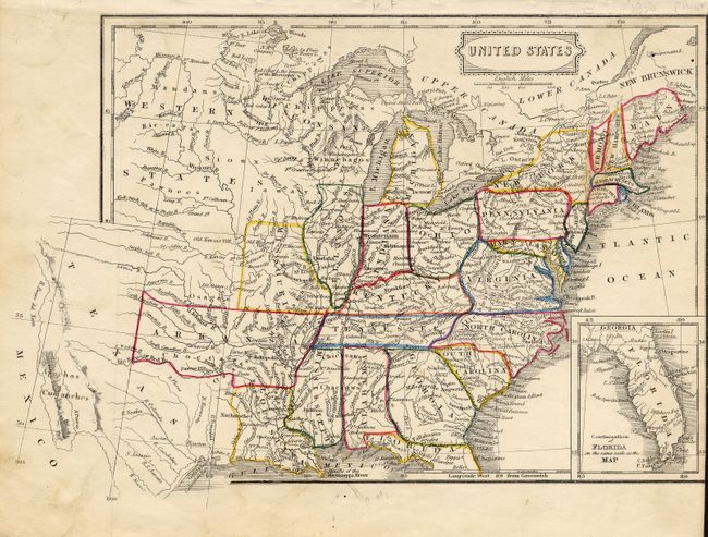
6) United States with Florida in inset. Original outline color, anonymous ( 9.5 x 7.5").
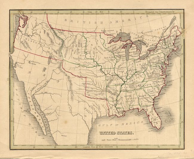
7) United States by Thomas Gamaliel Bradford , circa 1840. Original outline color (9.5 x 7.8").
References: Map 4 Jolly GENT-170; Fite & Freeman #55, p. 218-221; McCorkle #763.3; Sellers & Van Ee #110.
Condition: A
Most of the maps are very good. Map 3 with irregular toning, Map 5 with offsetting, Map 6 two small worm holes in margin and a stain in map.