Subject: Eastern United States
Period: 1824 (dated)
Publication:
Color: Hand Color
Size:
18.6 x 15.4 inches
47.2 x 39.1 cm
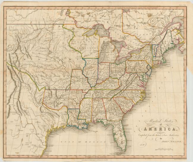
An unusual edition of a map by the important American cartographer John Melish, engraved by Sidney Hall. The map extends west to the Rocky Mountains and provides a detailed view of the Missouri River based on information from Lewis and Clark's expedition. A notation at the western edge of the map shows where "Clarks Canoes stop 3000 miles from the Mississippi." The large Arkansas Territory takes in most of present-day Oklahoma with the balance of the West being Missouri Territory and North West Territory. Texas is a state in Mexico, with the town of Galvezton noted. Dated 1820 below cartouche with publisher's imprint, Baldwin, Craddock and Joy, in 1824 in bottom margin.
References:
Condition: B
Nice impression on sound paper with original color and folds as issued. The map has some light toning and a few spots of foxing. Trimmed to the neatline for binding with a short binding tear repaired with archival tape.