Subject: Canada and Alaska
Period: 1865 (circa)
Publication: Illustrated Atlas and Modern History of the World
Color: Hand Color
Size:
13 x 10 inches
33 x 25.4 cm
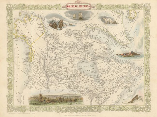
This is the later, and most desirable, edition of this decorative map of Canada and Alaska, here called Russian America. The map is surrounded in a delicately engraved border and further embellished with five vignettes. The vignettes include a seal, whaling scene, Esquimaux, polar bears, and a nautical scene showing Parry's ships Fury and Hecla. In this third state of the plate, a bird's eye view of Montreal replaces the Boston vignette. There is also a note inside the left border referring to the locations of Forts and principal Stations of the Hudson's Bay Company. The map was drawn and engraved by John Rapkin, while the illustrations were drawn by H. Warren and engraved by R. Wallis.
References:
Condition: A+
Original outline color in map with added later color to vignettes and border. This map does not have a centerfold. There is a bit of light surface soil in the margins, overall still fine.