Subject: Canada
Period: 1850 (circa)
Publication:
Color: Hand Color
Size:
13 x 10 inches
33 x 25.4 cm
Matched set of decorative maps showing all of British America and East and West Canada. These steel engraved maps were expertly rendered by John Rapkin with vignettes drawn by H. Warren and engraved by J.B. Allin and Robert Wallis.
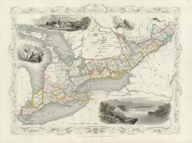
1) West Canada (12.6 x 10") covers the region of present-day Ontario and includes uncolored vignettes of Niagara Falls, an Indian encampment, Indians hunting bison, and river otters.
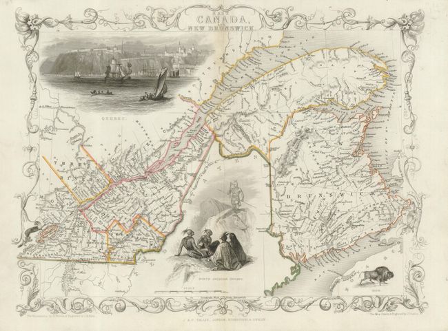
2) East Canada, and New Brunswick (13.4 x 10.3") is a fine map of the St. Lawrence River and New Brunswick. There are two large vignettes: a group of North American Indians, and a lovely view of Quebec with numerous sailing ships and boats in the foreground. A third smaller vignette shows a bison.
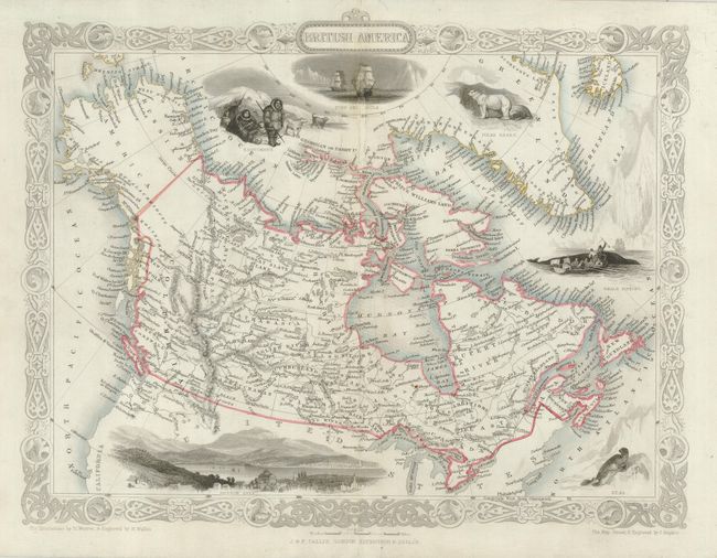
3) British America is surrounded by a delicately engraved border and further embellished with six vignettes. The map extends to show all of today's Canada and Alaska, here called Russian America. In Canada, at least 23 provinces are shown. The vignettes include a bird's-eye view of Hudson City, a seal, whale fishing, Esquimaux, polar bears, and a nautical scene showing the ships Fury and Hecla of Parry’s expedition.
References:
Condition: B
All three centerfolds have been reinforced with tissue with two short edge splits at top of each centerfold also repaired with tissue. #3 has a small area of paper restoration with some facsimile along top centerfold.