Subject: Canada - Hudson Bay - Arctic
Period: 1797 (dated)
Publication: Modern Geography
Color: Hand Color
Size:
7.1 x 9 inches
18 x 22.9 cm
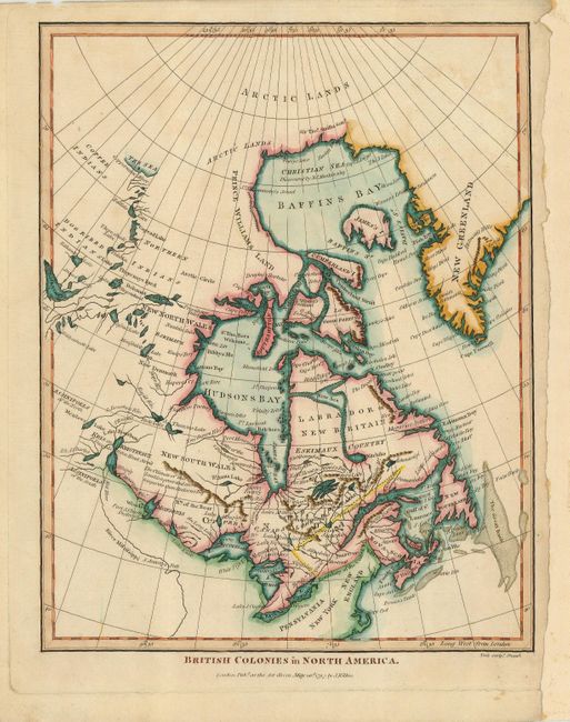
Very uncommon map showing British claims after the end of the Revolutionary War. The map shows an unusual configuration of interconnected lakes and rivers leading to Mackenzie Bay (The Sea) at the top. The interconnected waterways are most like Peter Pond's version , but it is lacking the waterway connected to Hudson Bay that leads to Mackenzie Bay. Hudson Bay is shown in the typical configuration of the period, depicting Greenland attached rather than as an island. However, a fictitious waterway has lopped off the top of Labrador, leaving that portion as an island, leading to a New Sea in the interior, which itself leads to another odd little lake below. A small and intriguing map.
References: Kershaw #396.
Condition: B+
Good impression with a little minor soil at the top. The right margin has been extended, but there is sufficient original margin for framing.