Subject: North America
Period: 1702 (circa)
Publication:
Color: Hand Color
Size:
7.5 x 5.5 inches
19.1 x 14 cm
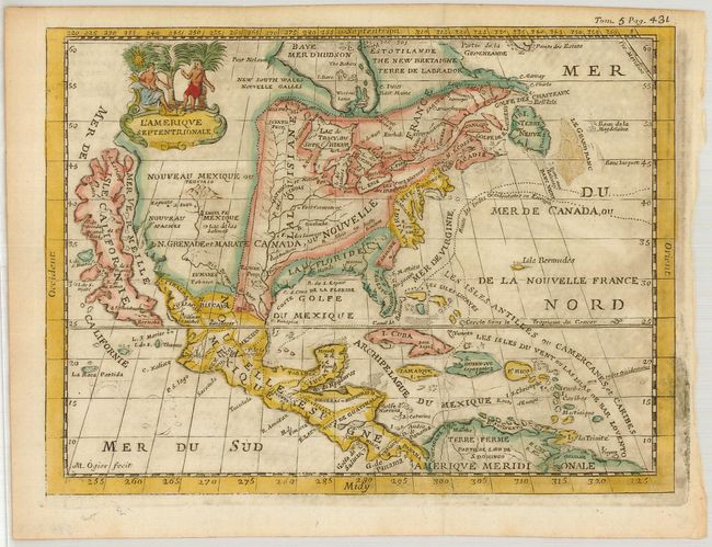
This scarce, charming map is very similar to the De la Feuille map of the same title (McLaughlin #147). It features a huge island of California with an indented coastline on the Fox model and the place names R. d' Estiete, C. Blanco, P. de Carinda, Canal de S. Barbe, I. de S. Martin, I. de S. Marc, B. de S. Francisco, B. de Simon, B.S. Christoue and Bernabe. The Rio Grande (Rio Bravo ou de Nort) is shown quite correctly for the period with its source in the mountains north of Santa Fe. The map is divided into French, British and Spanish colonial possessions. The map is decorated with a lovely little figural cartouche, and a ghost of a previously engraved adornment can be seen in the lower left part of the map.
References: McLaughlin #150.
Condition: B+
Some printer's ink residue in map, else very good.