Subject: Western Hemisphere
Period: 1806 (dated)
Publication:
Color: Hand Color
Size:
25.5 x 20 inches
64.8 x 50.8 cm
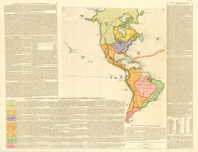
This is an uncommon Italian map of the Americas showing the political divisions and colonial possessions. Surrounded by detailed historical text and tables of information including the capitals and populations for the United States and its territories. The map includes a rudimentarily shaped Alaska (Alasca) and a note along the Northwest coast concerning Vancouver's discoveries. It also includes the Sandwich Islands, with a note about Captain Cook's discovery of them in 1779. The tracks of Christopher Columbus, Cortez and Pizzaro are shown as well.
References:
Condition: A
Impression is a little weak at the tip of South America, else fine with bright later color.