Subject: Atlases
Period: 1863 (dated)
Publication:
Color: Hand Color
Size:
15 x 18.5 inches
38.1 x 47 cm
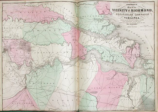
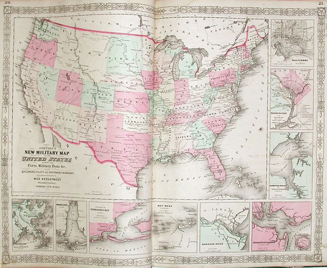
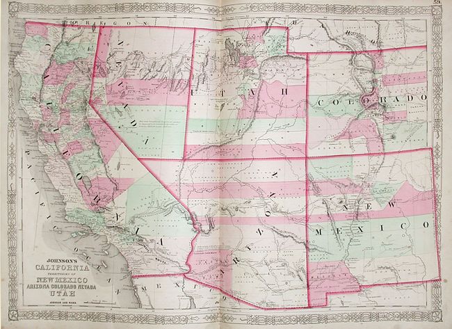
This complete transitional atlas contains 66 beautifully rendered, steel engraved maps with hand color and bright, crisp impressions. There are several thematic maps and diagrams interspersed throughout the text that display the geology, weather, tides, agriculture and animal kingdoms of the world. This 1863 edition is the last year with steel engraved plates and the version in which many of the maps feature vignettes and two different border styles. This atlas also features the double-page Civil War map Vicinity of Richmond and the New Military Map of the United States. The Southwest map is the first Johnson issue showing the newly created Arizona Territory with its first boundaries and with the old New Mexico county divisions, including the county of Castle Dome in the current location of Yuma County. This example also shows the early provisional boundary between Nevada and Utah which has moved eastward to the 115th Meridian. This very popular map is filled with interesting notations such as the description of the region near Quartzite, Arizona as being "exceedingly fertile and abundantly timbered and well watered." The map also shows forts, U.S. Mail routes, the Pony Express Route, the emigrant route to California and proposed R.R. routes. Folio. Original hardbound in quarter leather and green cloth. Gilt titles on cover and spine.
References:
Condition: B
Covers are scuffed and shelf worn with some loss. A small piece of the front cloth is missing, and the corners are bumped. Text and maps mostly good to very good with occasional foxing in image, paper is supple. The Ohio & Indiana map is torn in half and ragged around the edges.