Subject: South Pacific Ocean - Oceania
Period: 1840 (circa)
Publication: Atlas Universel Illustre
Color: Hand Color
Size:
16.5 x 11 inches
41.9 x 27.9 cm
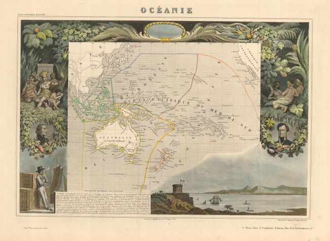
Victor Levasseur's "Atlas National Illustre" and "Atlas Universel Illustre" are among the last decorative atlases published. The maps are all lavishly illustrated with scenes of the countryside, products and activities indigenous to the region.
An attractive map from one of the last decorative atlases of the nineteenth century. The map covers the entire South Pacific, divided into four parts. Malaisie includes the islands of Southeast Asia. Micronesie includes the island groups between the Philippines and Hawaii. Melanesie includes Australia, New Guinea, the Salomon Islands and Figi. The largest division of Polynesie incorporates New Zealand and rest of the islands in the Pacific. The surrounding steel engraved scenes feature the natives of the region, portraits of French leaders, lush native foliage and a harbor vignette.
References:
Condition: A
Original outline color in map with later color in the vignettes.