Subject: Holy Land
Period: 1646 (dated)
Publication:
Color: Hand Color
Size:
21.5 x 16 inches
54.6 x 40.6 cm
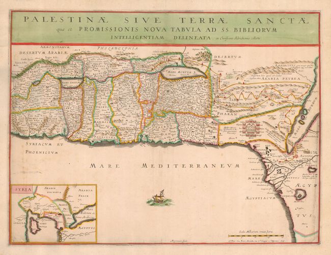
A very handsome and uncommon map of the Holy Land, based on Christian von Adrichem's two-sheet map of 1590. This map shows the shoreline from Sidon to Alexandria, and includes the mouth of the Nile. The map shows the division of the Twelve Tribes of Israel and the route of the Exodus, with tiny figures of Moses and his people exiting the Red Sea and the Pharoah's soldiers drowning within it. There are four burning cities, Adama, Sodoma, Gomorra and Seboim, in the Dead Sea. As on virtually all Holy Land maps of this period, the Sea of Galilee is shown connnected to the Mediterranean through the Kishon River at Haifa Bay. The eastern Mediterranean and Near East are shown in the inset map of Syria at the lower left, and a broken ship sails the sea. Engraved by A. Peyrounin.
References: Laor #21.
Condition: B
At right there is some professional paper restoration with the lower neatlines and a few lines of text in facsimile. The map has been trimmed to about 1/8" around the plate mark and has been mounted on 18th century paper, probably for inclusion in a composite atlas. Still an attractive piece that would be stunning framed.