Subject: World & Continents
Period: 1608 (circa)
Publication:
Color: Hand Color
Size:
6.7 x 5 inches
17 x 12.7 cm
Delicately engraved group of small maps of the continents and the world, featuring two projections of the world. These are all from an edition created in Cologne rather than Venice.
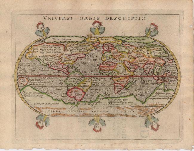
1) Universi Orbis Descriptio. The distinguished Italian geographer Giovanni Magini published a quarto edition of Ptolemy that also included this reduced version. Included were four world maps all engraved by Girolamo Porro. This map used the oval projection popularized by Abraham Ortelius, and follows that model very closely. Most notable are the large landmasses of Terra Incognita and Terra Australis at both poles. Six wind-heads are arranged above and below the map. Second state with Latin text on verso.
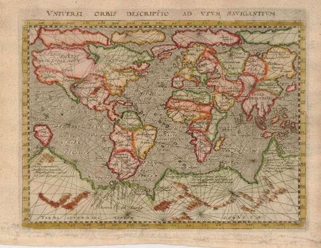
2) Universi Orbis Descriptio ad Usum Navigantium is a small mariner's map based on Gerard Mercator's large world map of 1569. Magini has added a fanciful range of mountains to the huge southern continent. The map is crisscrossed by rhumb lines and the oceans are stipple engraved in the Italian style. Second state with Latin text on verso.
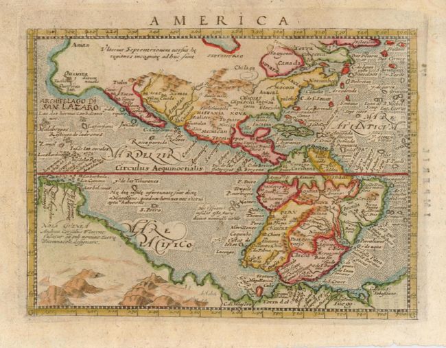
3) America is a finely engraved map derived from Giovanni Lorenzo d'Anania's 1582 map of the Americas and further based on the geography of Ortelius. Most notable is the characteristic bulge to the west coast of South America and the huge Southern Continent that attaches to Nova Guinea.
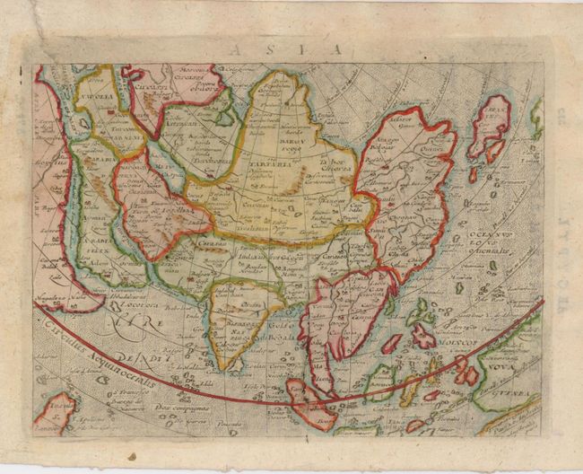
4 ) Asia is based on Ortelius' map of the region, with the same cordiform projection showing Asia extended too far to the east, an error propagated with Ptolemy. Japan is shown in a kite shape in the manner of Ruscelli from Jesuit sources.
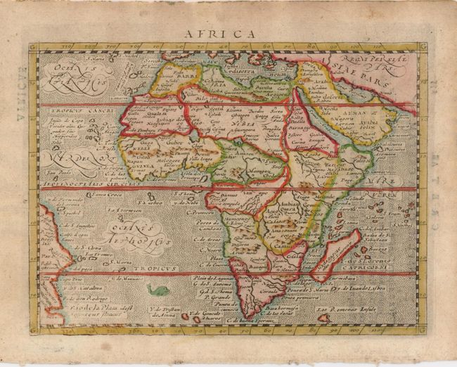
5) Africa is a small map of Africa and the Arabian Peninsula showing part of Brazil as well from the earlier mapping by Ortelius. The rivers of central and north Africa feature prominently including the Ptolemaic concept of the origin of the Nile in twin lakes south of the Equator. The largest of these lakes also has a river flowing southeast. The sea is stipple engraved with a tiny sea monster and decorative calligraphy.
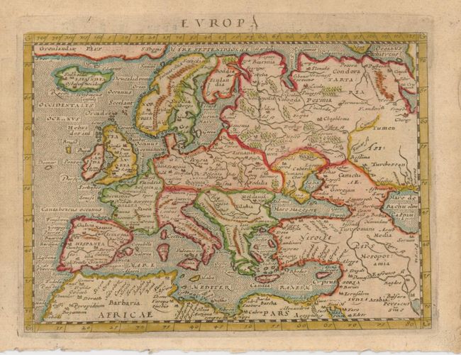
6) Europa shows the extent of the continent reaching over into Asia and including the northern tip of Africa as well as Iceland and Greenland. The seas are stipple engraved.
References: Map 1). Shirley #195; Map 2) Shirley #196; Map 3) Burden #93.
Condition: B
All maps are good with some uneven toning. Map 4 with a repaired tear in the upper left margin extending just into map.