Subject: Germany
Period: 1720 (circa)
Publication: Les Forces de l'Europe
Color: Hand Color
Size:
10 x 7 inches
25.4 x 17.8 cm
Nicolas de Fer held the title of geographer at Louis XIV's court. He was one of the most prolific publishers of plans of European cities in the late seventeenth century. The fortifications plans in Les Forces de l'Europe were designed to teach fortification techniques. Engraved by Van Loon and Schoonebeek after French engineers under the command of Vauban, the renowned military architect. The illustrations often include a description and a legend with the principal buildings; each city plan includes both fortifications and street layout.
Interesting group of plans depicting many forts attacked by Louis XIV during the War of the Grand Alliance. In the aftermath of the Thirty Years' War, which had devastated large parts of Southern Germany, the League of Augsburg was formed in 1686 between Leopold I, Holy Roman Emperor, and various German princes to oppose Louis XIV's incursions in Germany. The alliance was joined by Portugal, Spain, Sweden, and the United Provinces. Later, England also declared war on France in May of 1689, and the League of Augsburg became known as the "Grand Alliance," with England, Portugal, Spain, Sweden, the United Provinces, and most of the German states opposing France. The war came to an inconclusive end in 1696.
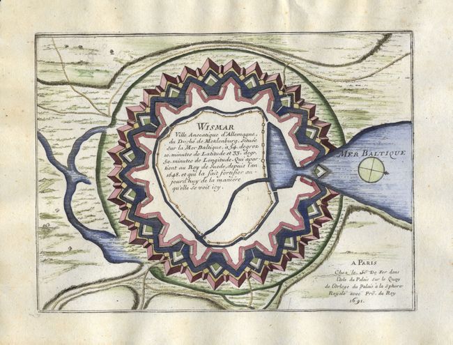
1) Wismar Ville Anseatique d'Allemagne, du Duche de Meklenburg, Situee sur la Mer Baltique… describes the fortifications of the town of Wismar on the Baltic Sea. The cartouche mentions that Wismar was given to Sweden in 1648 by the Treaty of Westphalia. Sweden renounced its claim to Wismar in 1903. The plan has a simple compass rose.
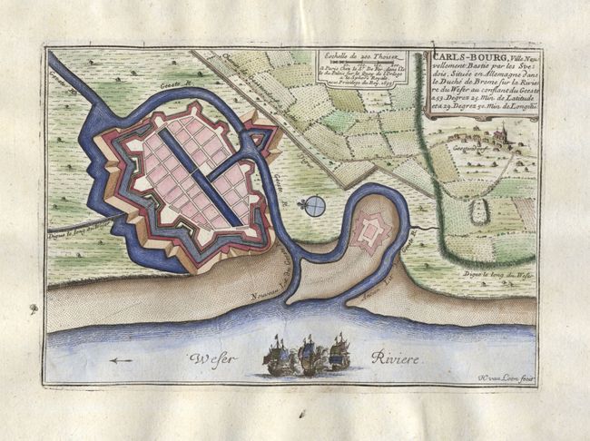
2) Carls-Bourg, Ville Neuvellement Bastie par les Svedois, Situee en Allemagne dans le Duche de Breme sur la Riviere du Weser… describes the fortifications in the town now known as Bremerhaven on the Weser River. The plan shows surrounding countryside and a nice scene of war ships in the river. Engraved by H. Van Loon
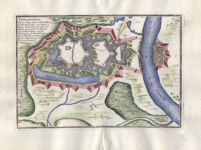
3) Philisbourg Ville tres Forte, Situee au de la Rhein de l'Eveche de Spire… shows the fortifications of Philipsburg on the Rhine River. This fort was taken by Mareschal Vauban under the command of Louis XIV in 1688.
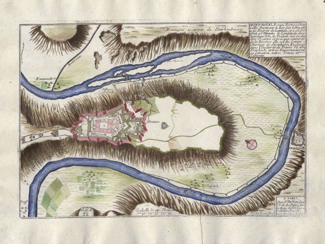
4) Mont-Royal, Est une Fortresse Nouvelle, Bastie par le Roy Sur la Moselle… describes the mountain-top fortifications in the town of Traben-Trarbach above the Moselle River. Engraved by H. Van Loon.
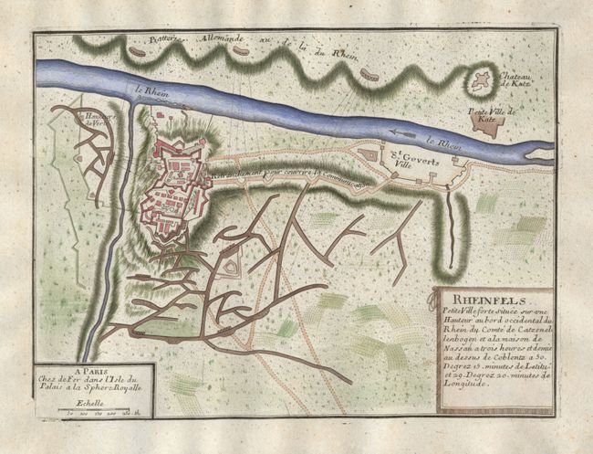
5) Rheinfels, Petite Ville forte situee sur une Hauteur au bord occidental du Rhein du Comte de Catzenellenbogen gives a nice view of Rheinfels Castle and the surrounding area near the Rhine River. In 1692, Rheinfels was the only fortress on the left bank of the Rhine to withstand attacks from Louis XIV's armies.
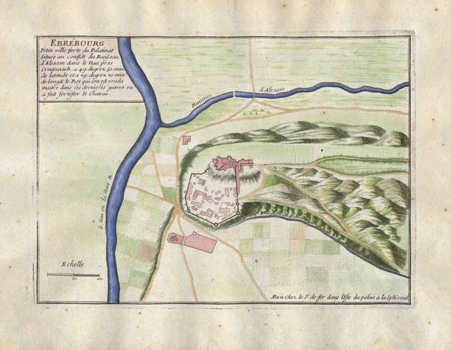
6) Ebrebourg Petite ville forte du Palatinat Situee au conflat du Ruisseau d'Alexem dans le nau prez Creutznach… details the fortifications and the region near Bad Münster am Stein-Ebernburg near Bad Kreuznach in the state of Rheinland-Pfaltz.
References: Pollak #21, p. 40.
Condition: B
Most are near fine except for a few small spots of foxing. Lovely later color with a small amount of show through on verso.