Subject: Bermuda
Period: 1671 (published)
Publication:
Color: Black & White
Size:
14 x 11.4 inches
35.6 x 29 cm
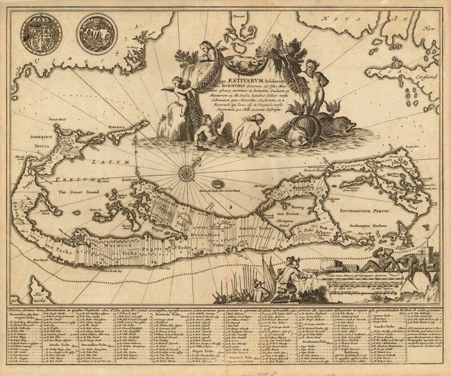
This attractive map is based on Blaeu's chart of the island (1635), which in turn was based on the famous survey by John Norwood of the Bermuda Company in 1618. The map shows the division into the original Tribes, or shares and shows the various landowners, with their names in a table below the map. Bermuda was colonized in 1612, just a little after Jamestown (1606). Roanoake Colony had already failed by this time, but it is noted on the map and in the cartouche. The map uses Blaeu's previous projection to show Bermuda's correct proportion and position in the North Atlantic by superimposing this map over a smaller scale map of the Atlantic with the coastlines of Britain, North America and Hispaniola, with a tiny island of Bermuda appearing just beneath the title cartouche. The map is decorated with an aquatic themed title cartouche, including Neptune riding a pair of sea monsters, surrounded by putti. The scale of miles cartouche shows a vignette of natives and Englishmen surveying the land, and the coats-of-arms for England and Bermuda are displayed at top.
References: MCC-19 #12 (Palmer).
Condition: B
Couple very light spots of toning, near fine. Narrow, but adequate margins, as issued.