Subject: Arctic and Scandinavia
Period: 1561 (published)
Publication: La Geografia de Claudio Tolomeo Allessadrino…
Color: Black & White
Size:
10 x 7.5 inches
25.4 x 19.1 cm
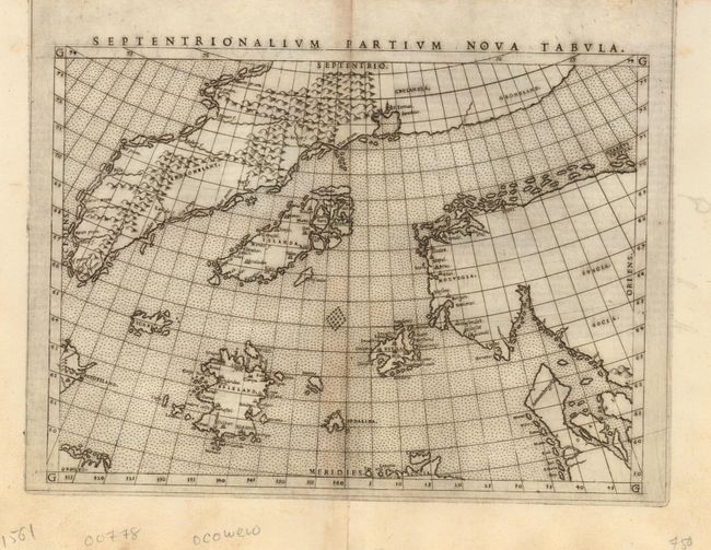
This is a reduced version the landmark Zeno map showing the mythical islands in the North Atlantic and small coastlines of Labrador (Estotiland) and possibly Newfoundland (Drogeo). Frisland is depicted in considerable detail, with many place names indicated. The only cartographic difference between this and the woodcut map published by Zeno is that there is no land bridge between Greenland and Scandinavia.
In 1558, Nicolo (the Younger) Zeno claimed to have discovered a 14th century manuscript recording a voyage made by his ancestors Nicolo and Antonio. According to the text, in the year 1380 a storm swept the Zenos into the North Atlantic where they found a group of unknown lands named Frisland, Estotiland, Estland, Icaria, and Drogeo. As a result, maps throughout the 16th century continued to show these fictional islands, especially Frisland. Italian text on verso. First edition and state.
References: Burden #29; Ginsberg #19; Manasek #19.
Condition: B
Superb impression on sturdy sheet with light toning on the centerfold.