Subject: Colonial South Carolina
Period: 1778 (circa)
Publication:
Color: Black & White
Size:
23 x 16.5 inches
58.4 x 41.9 cm
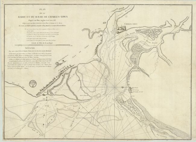
This is a French edition of Sayer & Bennett's important Revolutionary War chart of the entrance to the Charles River and Charlestown. Oriented with north to the right, the detailed map presents soundings, currents, anchorages, shoals and banks, navigational hazards, and the lighthouse and beacon. Along the shore are pictorial depictions of grand plantation homes, Forts Sullivan and Johnson, and the village of Charleston huddled around two churches. This French edition was redesigned to eliminate the references to Peter Parker's battle at Fort Sulivan and sailing directions were added. Published by the Depot de la Marine with their logo below the sailing directions.
References: Sellers & Van Ee #1549.
Condition: B
Trimmed close (1/8") at bottom and left with some light surface soil in map.