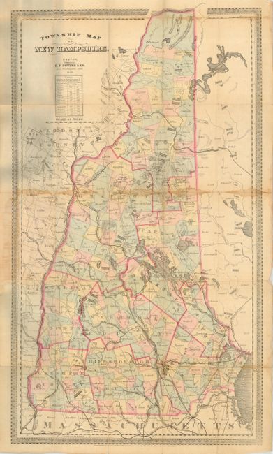
Subject: New Hampshire
Period: 1868 (dated)
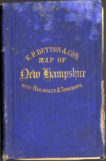
Publication: E.P. Dutton & Co's. Map of New Hampshire with Railroads & Townships
Color: Hand Color
Size:
15 x 26.5 inches
38.1 x 67.3 cm
This scarce pocket map shows the topography, counties, townships, railways, roads, rivers, lakes and coastline in excellent detail. The counties are outlined in red and townships are delineated and colored in alternating, pastel shades of red, yellow, green and blue. A table near the title displays the distances of several communities to Concord and Boston. This map folds into blue cloth boards, 3.5 x 5.8", with gilt stamped title. A paper pastedown on the inside front cover advertises other maps published by E.P. Dutton.
References:
Condition: B
Damp stains along folds with several small fold separations. Covers are shelf worn with some damp stains. Still a nice example of a charming pocket map.