Subject: Kentucky
Period: 1831 (circa)
Publication: A New General Atlas
Color: Hand Color
Size:
8.6 x 11 inches
21.8 x 27.9 cm
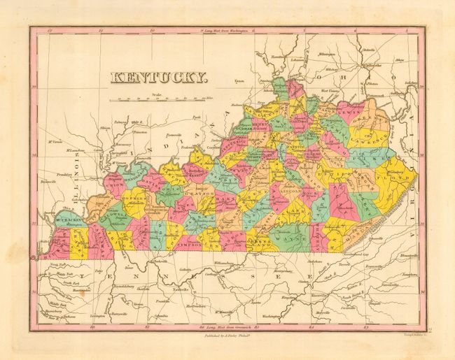
This fine, early map of the state shows county development to approximately 1830. Hancock County, formed from Davies, Breckenridge and Ohio Counties in 1829, appears on this map. The modified border of 1830 between Lawrence and Greenup Counties also appears, but no later changes are apparent. The map details the roads, towns and settlements of the day, the Cumberland Gap, and more. Beautifully engraved by Young & Delleker and colored in vivid pastel shades. Finley published his atlases between 1824 to 1834, with separate issues published in the years 1824, 26, 29, 30, 31, 33 and 1834, according to Ristow. A beautiful example of this map.
References: Ristow pp 268-70.
Condition: A
A very nice example with lovely original hand coloring, full margins and crisp, early impression. One light spot in map outside of Kentucky in an uncolored area, else fine.