Subject: United States - Northwestern
Period: 1852 (dated)
Publication: Schoolcraft's Information Respecting the History... Indian Tribes…
Color: Hand Color
Size:
10.3 x 8 inches
26.2 x 20.3 cm
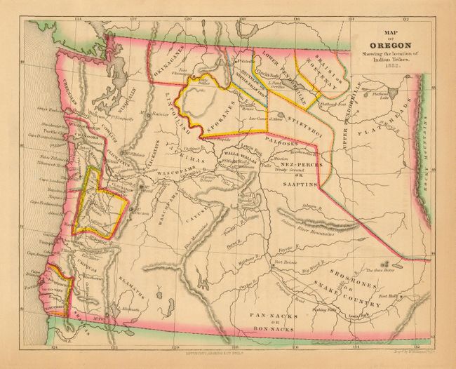
This great map of Oregon Territory is filled with information concerning the Indian tribes of the region. The area covered extends from the Pacific to the Rocky Mountains beyond Flathead Lake. There are several tribal regions delineated with different colors, with others simply named. Villages are noted, as well as Indian Agencies, Missions, and Treaty Grounds. Numerous early settlements are shown including Astoria, Salem and Portland. Across the Columbia River from Astoria is a community named Bernies. Military posts include Forts Flathead, Colville, Okonagan, Nisqually, Vancouver, Walla Walla, Boisee and Hall. The Olympic Peninsula is completely blank except for a range of mountains, wildly placed in a straight line down the center of the peninsula. There is good detail of major rivers. The Emigrant Road follows the Salmon River to Fort Boise, then veers northwest to join the Columbia River at Agency House. Engraved by W. Williams.
References:
Condition: A
Toned in blank margins with lovely original outline color.