Catalog Archive
Auction 119, Lot 16

"Tabula Geographico-Hydrographica Motus Oceani, Currentes, Abyssos, Montes Igniuomos in Universo Orbe Indicans, Notat Haec Fig. Abyssos Montes Vulcanios", Kircher, Athanasius
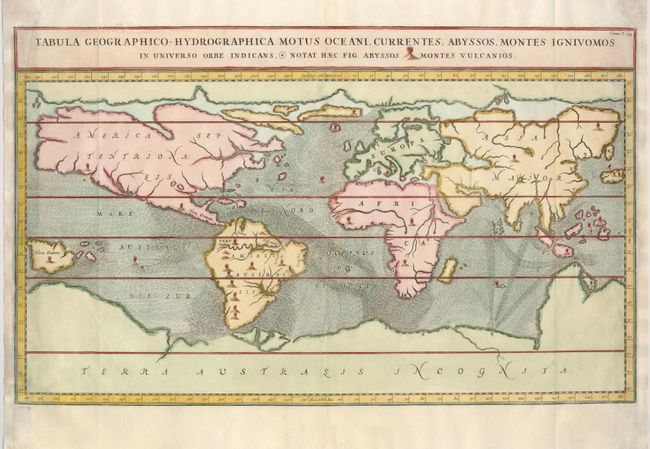
Subject: World

Period: 1665 (circa)

Publication: d'Onder-Aardse Weereld

Color: Hand Color

Size:
22 x 13.3 inches
55.9 x 33.8 cm
Download High Resolution Image
(or just click on image to launch the Zoom viewer)

The Jesuit scholar Athanasius Kircher was one of the first compilers of semi-scientific knowledge about the physical features of the world. This extraordinary map depicts ocean currents, volcanoes and deep-sea chasms. The continents are void of political detail and only major lakes, rivers and volcanoes are shown. There are prominent Northwest and Northeast sea passages and a vast southern continent. Kircher's theories included the notion that the world's oceans were all interconnected and subterranean tunnels are shown connecting the oceans and seas. Published in a Dutch edition of Kircher's famous Subterranean World by Johann Waesberger

References: Shirley #436.

Condition: A

Nice, sharp impression. The right and left margins have been professionally restored using the leaf casting method with a little facsimile of the neatlines.

Estimate: $800 - $900

Sold for: $850

Closed on 5/9/2007

Archived