Subject: United States
Period: 1858 (dated)
Publication:
Color: Hand Color
Size:
25 x 21 inches
63.5 x 53.3 cm
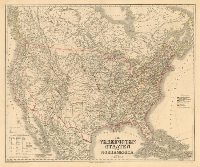
Large and very detailed German map issued prior to the outbreak of the Civil War. It covers the United States with parts of Canada and Mexico. This example has a large New Mexico Territory that names the Arizona district, and the Utah Territory includes most of Nevada and some of Colorado. The states and territories are shown with superb detail of railroads, rivers, topography and emigrant roads. A color key at right shows the states divided into several regions, including the slave states. A large and uncommon map.
References:
Condition: A
A clean, bright example. Three small wormholes, one inside image. and only visible when held to light. Damp stains and a few chips in margins, not reaching image.