Subject: Exploration and Surveys
Period: 1854 (dated)
Publication: 33rd Cong., 2nd Sess.
Color: Black & White
Size:
6.3 x 9.8 inches
16 x 24.9 cm
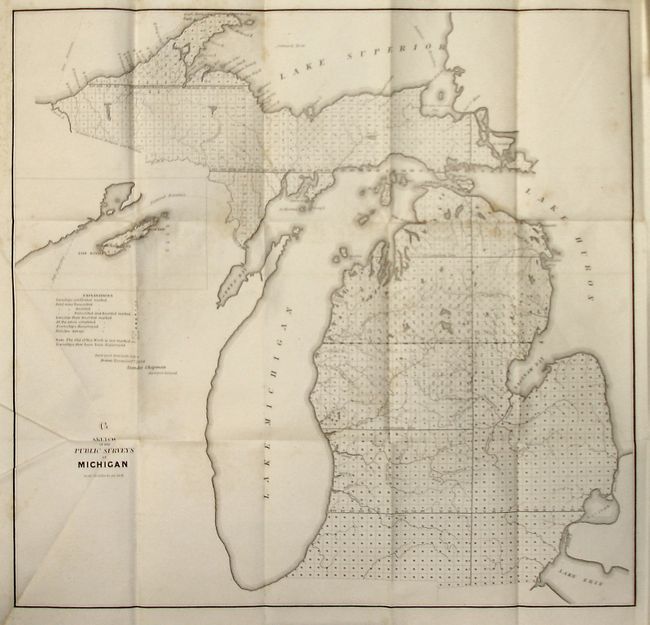
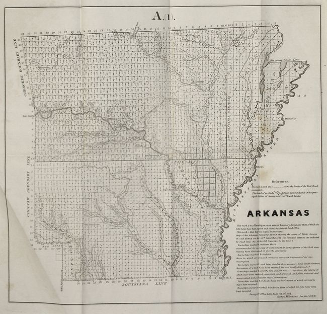
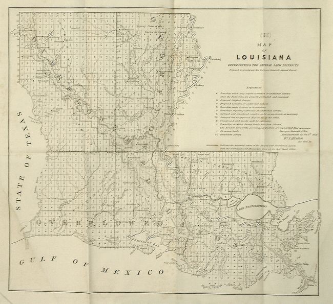
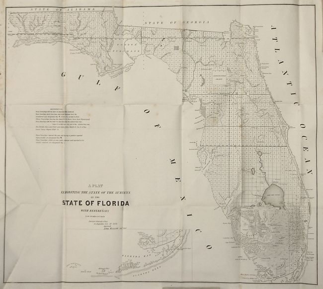
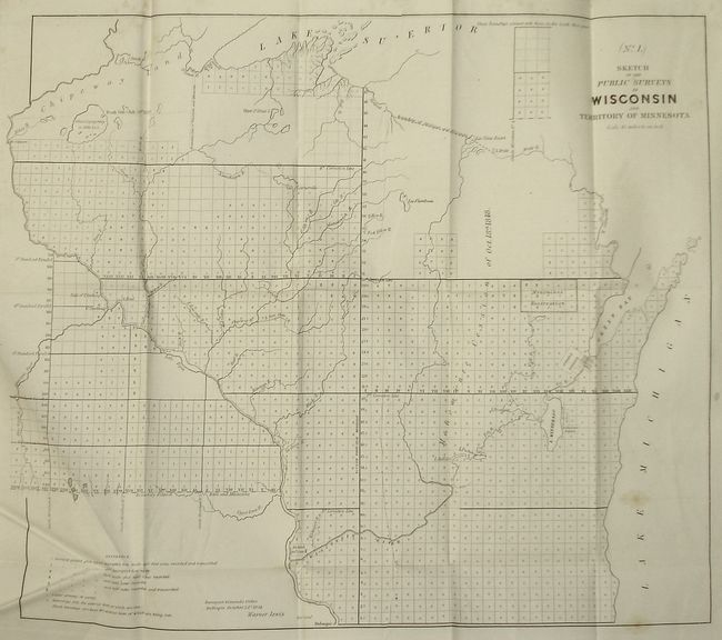
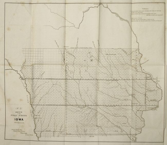
The report provides a brief summary of the inception and progress of the Land Grant System and explains how it is administered. It also provides interesting details regarding problems and their resolution. The seven original maps show the progress of surveys with an explanation key providing the status of each plat. The maps include:
Sketch of the public surveys in Michigan. Isle Royale is shown in an inset. 21.5"x21"
Arkansas15.5"x16.5"
Map of Louisiana15"x16"
A Plat Exhibiting the State of the surveys in the State of Floridaincludes an inset of Key West down to Dry Tortugas. This example also shows the Arredondo Grant, and Forbes' Purchase. 25"x22"
Sketch of the public surveys in Wisconsin and Territory of Minnesota20"x17.5"
Sketch of the public surveys in Iowa17"x20"
Untitled map of the Kansas and Nebraska Territories. 18"x11.5"
142 page report. Softbound in yellow paper. 8vo.
References: cf Koepp No I-85-1-1 (1849).
Condition: B
Heavy shelf wear and bumping. Damp staining in upper corner of all pages. Several signatures uncut. Maps have minor toning and foxing, otherwise good.