Subject: Atlases
Period: 1820 (dated)
Publication:
Color: Hand Color
Size:
13 x 16 inches
33 x 40.6 cm
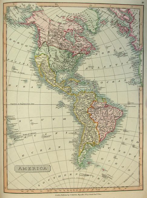
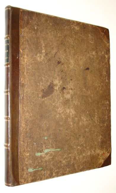
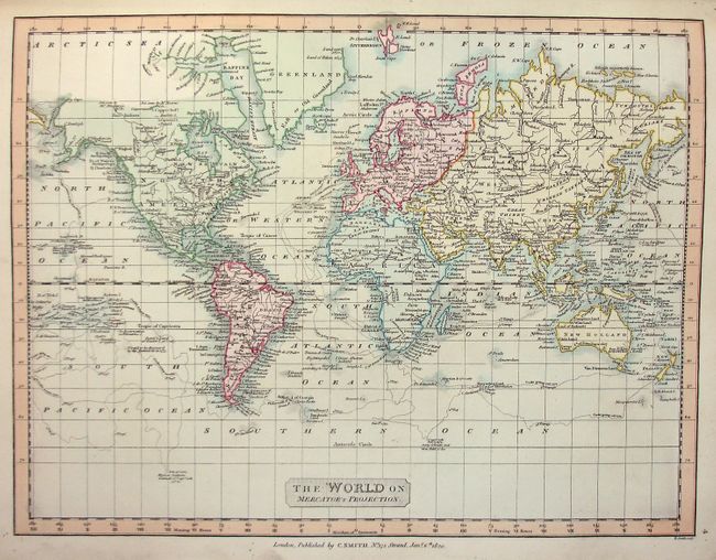
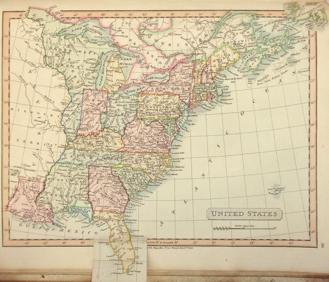
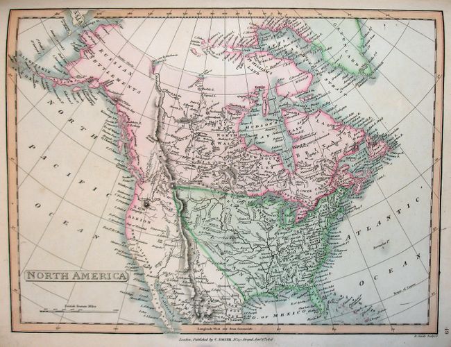
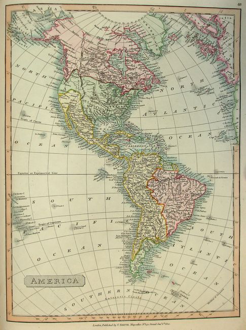
This is an unusually fine and complete example of this important and desirable atlas. All of the maps are finely engraved with full, original hand coloring. The map of North America shows Louisiana ending at the Continental Divide. Spain is in control of the entire west coast, here called New Albion with an indistinct northern boundary. Alaska is Russian Settlements and is completely blank inland. The map of the United States features a large North West Territory west of Lake Michigan. The entire region comprised of today's Minnesota, Wisconsin, Illinois, Indiana, and Ohio are labeled Western Territory. Florida is divided into East and West. The map extends to Louisiana with a large Missouri Territory to the north. A pasted down folding flap continues the panhandle of Florida. Two world maps, double hemispheric and on Mercator's Projection, plus a hemispheric map of the North Pole. All of the maps are full page except France according to the Treaty of Paris and The Russian Dominions…, both are larger and folding, and two double page maps of Germany. Also two double page maps of India meant to be joined to form one large map. This folio atlas is hardbound with brown quarter leather with ribbed spine and black gilt embossed leather label. Engraved title page by Halliwell, table of contents, and 53 hand colored copperplate maps.
In addition to the publishing business, Charles Smith & Son sold maps and globes in London in the first half of the 19th century. The elder Smith held the post of "Engraver and Map Seller Extraordinary to H.R.H. the Prince of Wales." This well known father and son team produced many maps and atlases including the New English Atlas, reissued numerous times between 1804-1864, and the New General Atlas, first published in 1808 and reissued several times up to 1836.
On the front cover pastedown is the bookplate of William Erle. This is most likely Sir William Erle (1793 - 1880) who was an English lawyer and judge. In 1819 he became counsel to the Bank of England, then sat in Parliament for the City of Oxford between 1837 and 1841. Erle was made a judge in 1845, the position he held until retiring to his estate at Bramshott in 1866. This is a very nice and complete example of this atlas.
References:
Condition: A
Covers show light soiling, rubbing and a little staining. Leather spine with minor shelf wear at bottom, otherwise fine. Maps clean and bright, with occasional light toning at edges, but generally fine. Endpapers are moderately soiled. Previous owner's signature in ink on first free endpaper.