Subject: Aviation Charts
Period: 1929-43
Publication:
Color: Printed Color
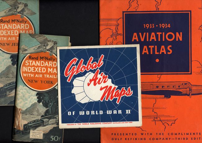
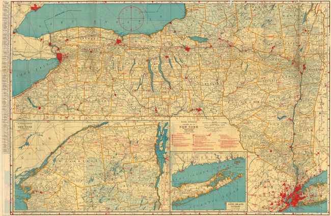
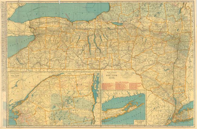
1) "Rand McNally Standard Indexed Map with Air Trails - New York," Chicago, Rand, McNally Co., 1929. Folds into pictorial wrappers, 72 pp., ads, large folding map, 37.3 x 25.5, with insets of Long Island and northern region. The map is printed on both sides, one side shows air trails. Created for pilots, the map features red overprinting to locate public airports, restricted airports, sea plane ports, sea plane anchorages, established airways, beacon lights of all types, and aids to navigation including radio stations, directional beacons and radio marker beacons. The airways are boldly marked and include their intersections with magnetic courses to and from. Contains a great full-page Coca-Cola advertisement. Self folds to 4.3" x 9", printed color cover with a steam locomotive and airliner. Loose from its cover with slight loss where previously pasted in and a few fold intersection splits.
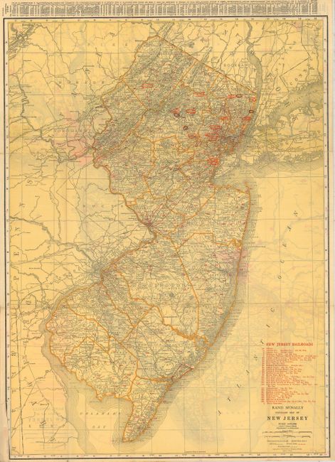
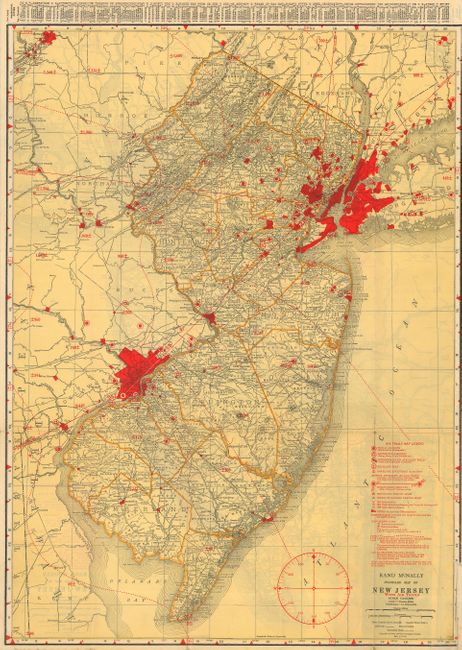
2) "Rand McNally Standard Indexed Map with Air Trails - New Jersey," Chicago, Rand, McNally Co., 1929. Folds into pictorial wrappers, 38 pp., ads, large folding map, 19.8 x 26.8", printed on both sides, with one side showing air trails. The same details as noted in the New York chart above. A few fold separations.
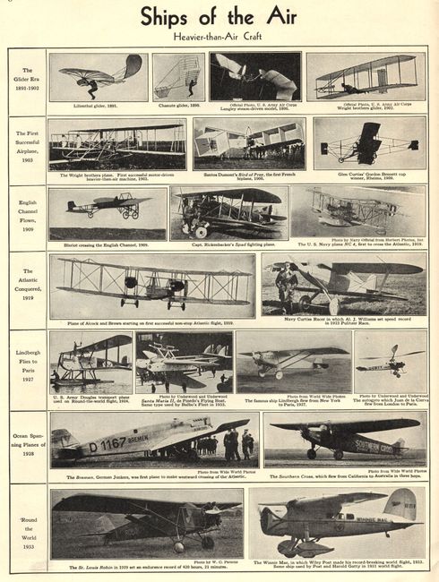
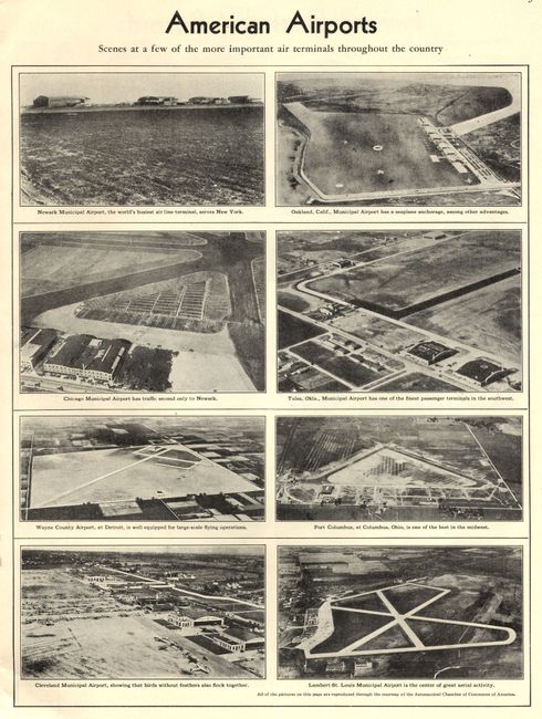
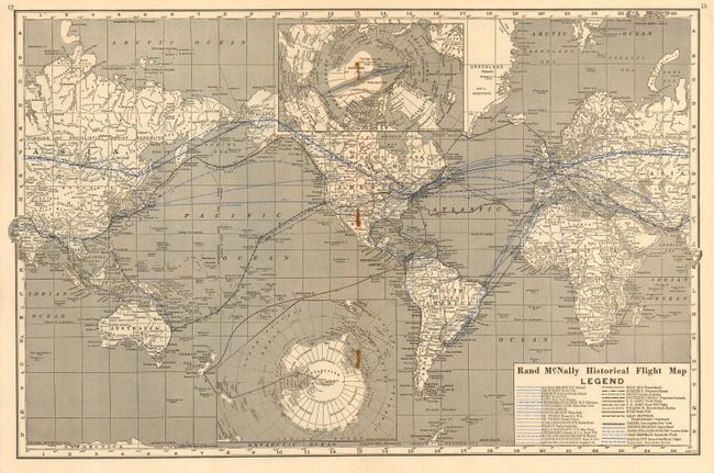
3) "1933-1934 Aviation Atlas," Gulf Refining Co., Pittsburgh. Third Edition, 1933. Small folio, 10 x 13.2", pictorial wrappers featuring a sexy twin-engine low-wing transport aircraft, 24 pp. Contains Rand McNally maps and many illustrations of airships, American airports (the photo of Newark, "the world's busiest air line terminal" will surprise you), famous flyers, aviation leaders and a chronological review of aviation history. The double page center map is a historical flight map of the world that delineates the routes of 33 ground breaking flights. Fine copy of this scarce aviation atlas. Phillips 5332.
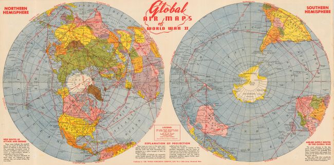
4) "Global Air Maps of World War II," Cleveland, World Publishing Co., 1943. This map measures 27.5 x 14" and folds into 7" x 7" self-wrappers. Shows polar projection and air routes for a map product called "new global maps" described in the text. One side is a large double hemispheric map of the world with red overprinting to detail New Routes of Attack and Defense and Airline Supply Routes in this Global War. Lovely map in full printed color with a little soiling at edge of front cover.
References: 3) Phillips (A) #5332.
Condition:
Condition ranging from good to fine - see item description.