Catalog Archive
Auction 118, Lot 794

"A Map of the Holy Land, Chiefly accommodated to the other books of Iosephus, wherein is continued the History of the Iewish Nation…", Wells, Edward
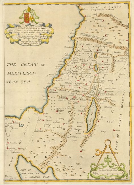
Subject: Holy Land

Period: 1700 (circa)

Publication:

Color: Hand Color

Size:
12 x 17.2 inches
30.5 x 43.7 cm
Download High Resolution Image
(or just click on image to launch the Zoom viewer)

Scarce map of the Holy land, based on the writings of the ancient Jewish historian Flavius Josephus, showing the coastal region from Syria along through Galilee, Samaria, Judea, Pera, to the western portion of the Red Sea. The map is decorated with a beautifully engraved cartouche and an ornate caliper scale of miles.

References:

Condition: A

Brown, paper hinges in upper, blank corners, well away from map.

Estimate: $400 - $600

Sold for: $400

Closed on 3/6/2007

Archived