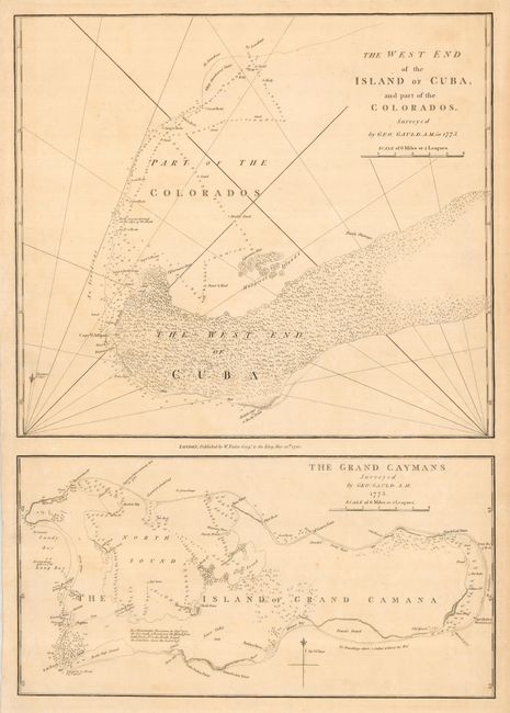
Subject: Grand Caymans and Cuba
Period: 1790 (dated)
Publication:
Color: Black & White
Size:
15.5 x 22.5 inches
39.4 x 57.2 cm
Two rare maps on a single sheet, both from surveys made by George Gauld of the British Admiralty in 1773. The map at bottom, of the Grand Caymans is the first map of the island. It locates the first settlements and names many of the first landowners. The map at top covers the west end of the island of Cuba, which is shown to be mostly uninhabited.
Between 1764 and 1781 the Scottish surveyor George Gauld was assigned by the Admiralty to chart the waters of the Gulf of Mexico and the Caribbean. He is most remembered for his pioneering survey of the Gulf Coast of British West Florida, an area extending from New Orleans to present-day Florida. He was taken prisoner at the siege of Pensacola in 1781. He was then taken to Havana, and released to New York, being repatriated to England, where he died shortly afterwards at the age of fifty.
References:
Condition: A
Bit of faint uneven toning, else fine.