Subject: Gulf of Mexico and Caribbean
Period: 1749 (dated)
Publication: Hydrographie Francais
Color: Hand Color
Size:
32.2 x 21.2 inches
81.8 x 53.8 cm
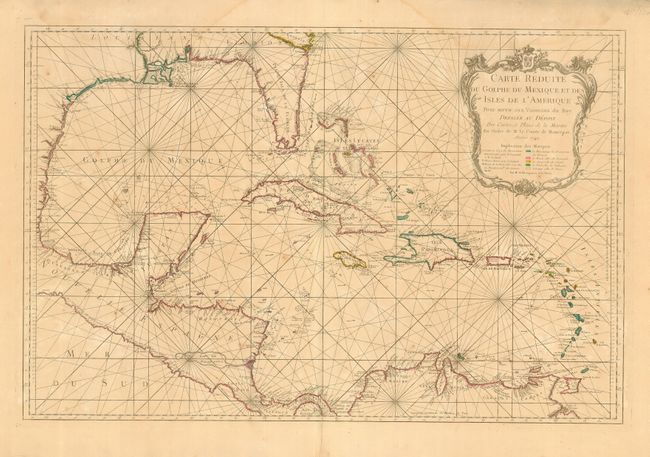
First edition of this large and impressive map of the Gulf of Mexico and the Caribbean color-coded to indicate the different areas of European colonial influence. The map was clearly meant to facilitate sailing, showing the locations of safe anchorages, navigational hazards and the directions of major currents. The map is decorated with an elegantly engraved cartouche, surmounted with the French coat of arms.
References: Phillips (A) #588, Vol. 2 #67; Tooley (MCC-96) #747.
Condition: B
Original outline color with a couple of spots of foxing. Light damp stain at the top, just into map. Some marginal chips and short splits in the wide, generous margins. Lower centerfold with some short, marginal tears, reinforced on verso with archival tape.