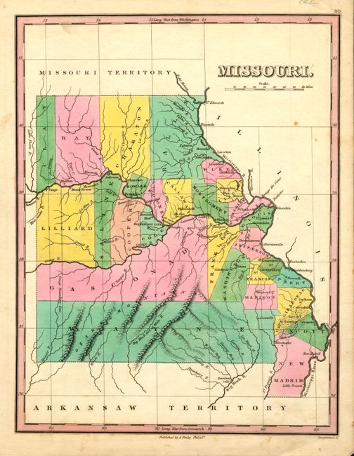
Subject: Missouri
Period: 1824 (published)
Publication: A New General Atlas
Color: Hand Color
Size:
8.6 x 11.2 inches
21.8 x 28.4 cm
Finely's maps employ a delicate and elegant engraving style and provided extensive topographical and watershed information. He was the dominant map maker in the United States in the early 1820s into the 1830s. His atlases were very successful, outselling rival atlases by Carey & Lea, and Tanner. His maps were printed on high quality paper and were routinely corrected and updated.
Lovely map of the state that was engraved less than three years following statehood. The map details the county seats, roads, towns and settlements. Development is primarily along the rivers with virtually no other settlements noted in this early and fascinating map. The map shows 27 counties, correct for 1824, includes the 1824 gain from Girardeau county by Scott. Crisp engraving by Young & Delleker.
References:
Condition: A
Fine coloring and impression on thick paper. A couple light foxing spots in blank areas of map, still very good considering the fine color and impression.