Subject: Florida
Period: 1867-73
Publication:
Color: Hand Color
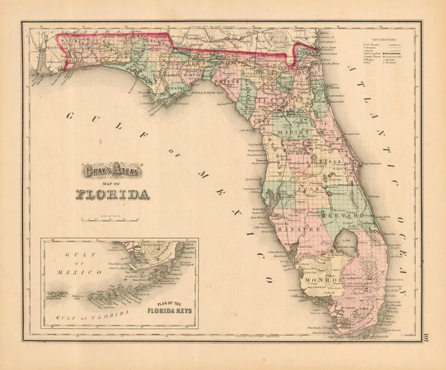
The first map is "Gray's Atlas Map of Florida," 1873, 14.8" x 11.8". This first edition map is from the Atlas of the United States. The map details swamps, lakes, towns and counties. A large inset provides exceptional detail of the keys and the Tortugas Islands. Railroads traverse the eastern panhandle with one line extending south to the Cedar Keys, and another to Ocala with planned expansion to the Tampa area. An isolated railroad arrives in Pensacola from Alabama. Equally nice full-page "Map of Alabama" on the verso.
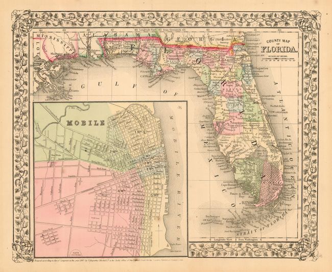
The second map is Mitchell's "County Map of Florida," 1867, 13" x 10.5". Published in Philadelphia, the map features Mitchell's lovely grapevine border and a large, detailed inset plan of Mobile. Good detail throughout shows Florida with approximately thirty counties. The railroads transverse the panhandle to Tallahassee and south to Atsena Otie near the Cedar Keys. The Everglades and Big Cypress Swamp cover the entire southern portion. Miami is named.
References:
Condition: A
Both with original color and fine impressions. The former has some very light offsetting or foxing in the blank ocean. The latter has a few insignificant spots.